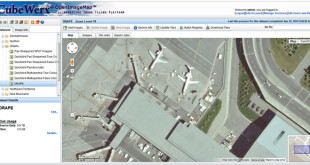
Raster support
Since PostGIS version 2, raster has been supported in the database. The raster data model can dramatically increase the use of PostGIS as a analytical and visualization tool. For example elevation models and a lot of environmental data are based on the raster data model.
Now GC2 supports PostGIS raster data. Raster layers will be displayed in the list of layers in the database tab and you can manage them in the same way as vector layers. Raster layers will also be added to the tile and WMS services and you may classify them. You can also query the raster tables through the SQL API.
Read more about raster support and how you upgrade your own GC2 installation
New Ubuntu 14.04 server images
Ubuntu 14.04LTS (Long Term Support) was released in April and is packed with newer versions of the geospatial software. We are ready with a new vmdk file for use in VMWare products, Oracle VirtualBox etc. The highlights are:
PostGreSQL 9.3
PostGIS 2.1
MapServer 6.4
Apache 2.4
GDAL 1.10
PHP 5.5
You can also spin a GC2 server up at Amazon Web Services in a couple of minutes.
Europe or USA
If you want to install from scratch instructions for Ubuntu 14.04 are ready
