Supergeo Technologies, a leading global provider of complete GIS software and solutions, announced that the latest iOS-powered SuperSurv 3.2 is officially released to bring powerful GIS functions for streamlining field data collection for Apple devices users.
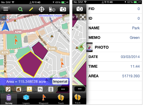
Designed for field survey with iPad and iPhone, SuperSurv 3.2 for iOS supports offline editing, attribute query, tracklog recording and display, adding Waypoint, and Augmented Reality. The whole new mobile GIS app integrates with GIS and GPS technologies to perform Map Display, Query, Measure, etc, and support point, line and polygon data.
SuperSurv 3.2 for iOS also allows users to employ OpenStreepMap as the basemap to collect feature data including attribute data, and save the data in SHP and GEO formats. Besides, the Customized Attribute Table is offered to effectively cluster attribute data. Data like collected layer files and GPS tracklog can be exported through iTunes and utilized in various GIS programs.
# # #
About Supergeo
Supergeo Technologies Inc. is a leading global provider of GIS software and solutions. Since the establishment, Supergeo has been dedicated to providing state-of-the-art geospatial technologies and comprehensive services for customers around the world. It is our vision to help users utilize geospatial technologies to create a better world.
Supergeo software and applications have been spread over the world to be the backbone of the world’s mapping and spatial analysis. Supergeo is the professional GIS vendor, providing GIS-related users with complete GIS solutions for desktop, mobile, server, and Internet platforms.