Tag Archives: Apple

Apple Maps Roundup: Apple Apologies, Alternatives, Reviews, and much more

Quite a lot of news related to the recent launch of Apple Maps along with iOS 6. We already mentioned some backlash and Google and Apple Maps. And here's what's new.

Most surprising is A letter from Tim Cook on Apple Maps, that starts with: "At Apple, we strive to make world-class products that deliver the best experience possible to our customers. With the launch of our new Maps last week, we fell short on this commitment. We are extremely sorry for the frustration this has caused our customers and we are doing everything we can to make Maps better." This was a topic discussed over Slashdot amongst many other digital places.

Other Apple Maps related news:

  • An entry on Apple's New App Store Feature Section for Alternative Maps Apps
  • Another Slashdot discussion on Why Apple Replaced iOS Maps
  • MacRumors also had an entry named How To Report a Problem With iOS 6 Maps Data
  • O'Reilly have a full article titled Apple's maps problem isn't about software or design. It's about data.: "As Stephen O’Grady has pointed out, the problem with maps is really a data problem, not a software or design problem. If Apple’s maps app was ugly or had a poor user interface, it would be fixed within a month. But Apple is really looking at a data problem: bad data, incomplete data, conflicting data, poor quality data, incorrectly formatted data."
  • If you're looking for Apple Maps reviews, TMR shares plenty of them (4 links), including: "A lot of people think that the new maps are a substantial downgrade, not just in terms of missing features (Street View) or features that will require third-party plugins (transit directions), but in terms of basic features like local search and directions. Josh thinks that local search is “a tremendous step backwards and something that cripples iOS for Apple’s customers” because it’s limited to names, addresses and Yelp categories."
  • APB also shared their Quick Take on Apple Maps in iOS 6
  • MapQuest took the opportunity to remind us in 2 entries about the updated MapQuest app for iOS
  • Direction Mag thinks Apple Needs to Acquire TomTom
  • Ogle Earth shares an entry on Apple Maps and the Diaoyu/Senkaku islands

My personal experience with Apple Maps was rather very positive so far. Maybe my region is just lucky, but the Apple Maps app is great looking, fast (for the data it displays) and was accurate enough for the 500km of roads where we've been relying on Apple Maps last weekend. And the 3D for my city (Montreal) is awesome, much better than the 2D Google-maps based iOS 5 app. I haven't used the Apple Maps search feature extensively and I haven't compared with what's being offered on Android nowadays.

Read More »
Major Backlash Looms For Apple’s New Maps App?

With today's release of iOS 6, Slashdot discusses a story named Major Backlash Looms For Apple's New Maps App.

Their summary: "Michael DeGusta writes that Apple's new Maps app is the very first item on their list of major new features in iOS 6, but for many iPhone and iPad users around the world Apple's new maps are going to be a major disappointment as the Transit function will be lost in 51 countries, the Traffic function will be lost in 24 countries, and the Street View function will be lost in 41 countries. 'In total, 63 countries with a combined population of 4.5 billion people will be without one or more of these features they previously had in iOS,' writes DeGusta. 'Apple is risking upsetting 65% of the world's population, seemingly without much greater purpose than speeding the removal of their rival Google from iOS. Few consumers care about such battles though, nor should they have to.' The biggest losers will be Brazil, India, Taiwan, and Thailand (population: 1.5 billion) which overnight will go from being countries with every maps feature (transit, traffic, and street view) to countries with none of those features, nor any of the new features, flyover and turn-by-turn directions. Apple's maps are clearly behind in some key areas, but they will presumably continue to improve over time. Google has committed to making their maps available everywhere, so it seems likely Google will release their own iOS maps app soon, as they did with YouTube, which has similarly been removed from iOS 6."

Read More »

Apple Launches New ‘Maps’ App in iOS 6, Includes Turn-by-Turn Navigation, Real-Time Traffic, 3D Maps

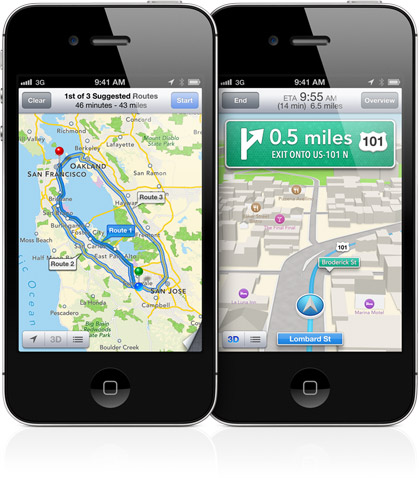
24 hours ago Apple announced  the new 'Maps' app for iOS 6, which includes turn-by-turn navigation, real-time traffic and 3D maps: "Designed by Apple from the ground up, Maps gives you turn-by-turn spoken directions, interactive 3D views, and the stunning Flyover feature. All of which may just make this app the most beautiful, powerful mapping service ever."

Here's the reactions on the geoblogs and other sources:

  • Let's start with MacRumors which were amongst the first to let us know about it
  • Spatially Adjusted links to the Apple attribution page for the Maps app, and it's TomTom data for navigation amongst other sources, and not surprisingly, there's still OpenStreetMap data in there like for the latest Photo app
  • Spatially Adjusted also shares an interesting entry named Will Apple Maps Impact Web Mapping? "Thus in the short term, it becomes one more API we must learn if we are deploying to Apple devices. [...] Second, it might not be useful for GIS applications. [...] Third, if you are already using Google or Mapbox, do you really need to switch?"
  • Peter Batty also shares an interesting reaction: "Another interesting development is that a good number of major car manufacturers have committed to adding a button on their steering wheel within the next 12 months that will activate Siri on your iOS device, which will make iOS devices even more attractive as in car devices. [...] The most obvious thing missing from Apple Maps that Google Maps has is Street View. They also didn't mention anything about an offline mode, which Google announced last week. [...]  Another thing missing, which I use a lot on Google Maps on my iPhone, is routing using public transit."
  • Adena at APB is collecting 'facts' about Apple's new Maps app
  • The Map Room links to Cult of Mac's 4-minutes hands-on demonstration of the Apple Maps app
  • You can read more on The Verge, Gizmodo, and several other generic sources 
  • If you want to see the 10-minutes video announcement and demo of the Maps app, fast forward to about 98 minutes into the talk

I expect more Apple Maps information and analysis in the coming weeks, and by the time it becomes available as part of iOS 6 "next Fall".

Read More »

Batch Geonews: GeoExplorer, Google vs Apple Maps, Unmanned Aerial Systems, London Olympics, Tornadoes, and more

Here's the recent geonews in batch mode.

From the open source front:

  • OpenGeo runs an entry named Five things you didn’t know about GeoExplorer

From the major companies front:

  • I liked the Google vs Apple mapping discussion from Peter Batty: "Google announces that it is scared of Apple Maps
    [...] Now don't get me wrong, Google is the market leader and Apple has everything to prove."
    See also his entry named Apple Maps: Predictions and Questions, which are also of course innovations Google could implement. Viva competition! (well ok, I admit I prefer cooperation ;-)
  • James has an interesting entry named One Man's Disruptor is Another Man's Incumbent, the incumbents are Google Maps, MapQuest, Esri and Microsoft, and the disruptors are MapBox, Esri and Apple
  • Via O'Reilly, the connection between Google Street View and driverless cars: "Now, I’m realizing the biggest Street View data coup of all: those vehicles are gathering the ultimate training set for driverless cars." Read the comments, driverless cars data is not simple
  • There's 2 new modules for Bing Maps V7: GeoJSON and WKT reader/writer modules
  • The GEB discusses Using StreetView to validate 3D models

Discussed over Slashdot:

  • NASA Tool Shows Where Forest Is Being Cut Down
  • Autralian Mining Companies Increasing Use of UAVs
  • Cognitive Software Identifies America's Brainiest Cities
  • John Carmack Is Building a Virtual Reality Headset
  • Trained Rats Map Minefields With GPS

In the everything-else category:

  • The eoPortal shares an entry named US not losing its foothold in Earth observing satellites, only shifting power
  • The eoPortal also mentions a new imaging system produces 3D models of monuments using unmanned aircraft
  • On that very topic, DM shares an article named Ten Things You Should Know About Unmanned Aerial Systems (UAS)
  • VerySpatial have an informative entry on geospatial at the upcoming London Summer Olympics and U.K. in general
  • AR as entertainment of the future? Kinect and RFID power an augmented reality theme park (via OR)

In the maps category:

  • Here's a nice visualization of 56 years of tornadoes in the U.S.

As a bonus for reading till the end, here's a interesting quote: "If a picture is worth a thousand words, a map can be worth a thousand spreadsheets."

Read More »

Google Geonews: Google+ Local Launched, Transit of Venus in Google Earth, Google Glasses Demo, and much more

Before tomorrow's event, here's the recent Google-related geonews.

From official sources:

  • Google launched Google+ Local, "a simple way to discover and share local information featuring Zagat scores and recommendations from people you trust in Google+"
  • There's New 45° imagery available for 26 cities:
    • US: Albany, GA (outskirts); Atascocita, TX; Clarksville, TN; Columbia, MO; Corpus Christi, TX; Fayetteville, NC; Fort Collins, CO; Fort Smith, AR; Greensboro, NC; Jackson, TN; Lafayette, LA; Plaquemine, LA; Pueblo, CO; Santa Fe, NM; Texarkana, AR; Tyler, TX
    • International: Bern, Switzerland; Cracow, Poland; Dublin, Ireland; Gdansk, Poland; Lugo, Spain; Ourense, Spain; Poznan, Poland; Warsaw, Poland; Wroclaw, Poland; Zurich, Switzerland
  • You can now Explore historic sites with the World Wonders Project
  • There's now Street View data over the Indianapolis Motor Speedway
  • And if you're in Europe instead, Explore the football stadiums of Poland and Ukraine as they prepare to host the European Championships
  • If you're a fan of bridges in the U.S., check out this entry named Band of Bridges: Celebrating the Golden Gate Anniversary

From other sources:

  • Here's tonight's Transit of Venus in Google Earth
  • Nate Irwin shares an entry named Google imposing more restrictions on Google Maps API, and since he mentions "For example, you are not permitted to: (i) use or provide any part of the Service or Content (such as map imagery, geocoding, directions, places, or terrain data) in an API that you offer to others", I wonder what it means for OpenLayers and other similar tools?
  • Here's a SearchEngineLand article named Google Places Is Over, Company Makes Google+ The Center Of Gravity For Local Search
  • You will see mostly talk and no actual demo, but here's Sergey Brin Demos Google Glasses Prototype
  • The GEB shares an entry named How Google Earth is being used by the Philippine National Police
  • Another rumors going in the same direction, Apple Replacing Google Maps On iOS With Its Own Solution Later This Year
  • The GEB shares the incredible 3D buildings of Istanbul, Turkey
  • And of course, there was new imagery too
Read More »

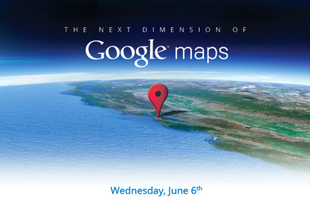
The Next Dimension of Google Maps Event Announced for June 6th

While we'll know in a few days what this presumably big announcement in terms of upcoming features is all about, Google sent an invitation to 'The Next Dimension of Google Maps' event that will be hosted next Wednesday. In addition to CNET, I saw it featured on Slashdot and MacRumors.

From the invitation: "At this invitation-only press gathering, Brian McClendon, VP of Google Maps and Google Earth, will give you a behind-the-scenes look at Google Maps and share our vision. We'll also demo some of the newest technology and provide a sneak peek at upcoming features that will help people get where they want to go -- both physically and virtually. We hope to see you there."

I like MacRumors' analysis: "The timing of Google's event naturally leads to speculation that it has been specifically planned to upstage any Apple announcement about mapping in iOS 6 and to show what users will be missing out on with the transition by Apple."

Read More »

Apple Moving to In-House Mapping Service with 3D Views in iOS 6?

MacRumors shares a long entry named Apple Moving to In-House Mapping Service with 3D Views in iOS 6?

From the 9TO5Mac report: "Apple will drop the Google Maps program running on iOS since in favor for a new Maps app with an Apple backend. [..] The most important aspect of the new Maps application is a powerful new 3D mode. The 3D mode does not come enabled by default, but users simply need to click a 3D button that is conveniently and visibly stored in the app. Perhaps under the fold like the current traffic, pin, and map view buttons. This 3D mode is said to essentially be technology straight from C3 Technologies: beautiful, realistic graphics based on de-classified missile target algorithms."

We mentioned in the past that Apple Acquired Web Mapping Firm Poly9 and Apple's C3 Technologies 3D Maps Also Offer Street Views and Interior Views.

Related, Apple's iPhoto maps now show attribution to OpenStreetMap, we mentioned Apple using OpenStreetMap data in March.

Read More »

Apple Using OpenStreetMap Data in iPhoto for iOS and OpenStreetPad for iOS

It's rare there is such great news for open geospatial data. Here's the "Welcome, Apple!" entry from the OpenStreetMap Foundation. Of course there are initial quirks, but it's a start and it's excellent pushing in favor of OpenStreetMap data.

From the welcome message: "The desktop version of iPhoto, and indeed all of Apple’s iOS apps until now, use Google Maps. The new iPhoto for iOS, however, uses Apple’s own map tiles – made from OpenStreetMap data (outside the US). [...] The OSM data that Apple is using is rather old (start of April) so don’t expect to see your latest and greatest updates on there. It’s also missing the necessary credit to OpenStreetMap’s contributors; we look forward to working with Apple to get that on there."

Of course, Slashdot is also discussing the news and MacRumors provides more insights: "Daring Fireball's John Gruber later clarified that Apple was still using Google Maps for the Places functionality in iPhoto for iOS but that maps for Photo Journals and slideshows were coming directly from Apple. [...] Toward that end, Apple has been working hard to beef up its own in-house mapping expertise over the past several years, acquiring several small companies including Placebase, Poly9 and C3 Technologies."

For the U.S., Apple is apparently using TIGER data. If you're curious, here's a nice tool to compare Apple tiles (based on OSM) and OpenStreetMap tiles. If you're eager for more coverage from the generic web sources, APB offers more links.

Related, you know I've been looking for an iOS editor of OpenStreetMap data for a while, and the great news is that the new open source OpenStreetPad project for iOS is exactly this!

Read More »

Patent Mess for Location-Based Reminders from Amazon, Apple, Microsoft and Google

Two days ago (yes, I was busy) Slashdot discussed a story named Amazon, Apple, Microsoft, and Google Chase 'Got Milk?' Patents.

Their summary: "Among the new iOS 5 features is Reminders, which Apple explains this way: 'Say you need to remember to pick up milk during your next grocery trip. Since Reminders can be location based, you'll get an alert as soon as you pull into the supermarket parking lot.' But does Reminders infringe on a newly-granted patent to Amazon for Location Aware Reminders, which covers the use of location based reminders to remind a user 'to purchase certain items such as, for example, as milk, bread, and eggs'? Or could Reminders run afoul of Google's new patent for Geocoding Personal Information, which covers triggering a voice reminder or making a computing device vibrate when a user approaches a location if 'one of the user's events is a task to pick up milk and bread'? Not to be left out of the 'Got Milk?' patent race, Apple also has a patent pending for Computer Systems and Methods for Collecting, Associating, and/or Retrieving Data, which covers providing a reminder to a user whose 'to do' list includes 'get milk' when the user's location matches 'a store that sells the item "milk."'

That should not be confused with Microsoft's pending patent for Geographic Reminders, which allows users to specify reminders such as 'pick up milk if I am within a ten minutes drive of any grocery store.' That all four tech giants chose to pursue remember-the-milk patents — and the USPTO is considering and granting them — is all the more remarkable considering that Microsoft suggested location-based reminders were obvious in a patent filing, which informed the USPTO that 'a conventional reminder application may give the user relevant information at a given location, such as 'You're near a grocery store, and you need milk at home.' So much for that immediate patent quality improvement promised by the America Invents Act!"

​You bet the patent system needs to be overhauled!

Read More »

Apple’s New Patent Weapon — Location Services

That's the story discussed over Slashdot this morning, Apple's New Patent Weapon — Location Services.

Their summary: "Once again, it seems Apple is about to take intellectual property claims to a new level. Apple has been reissued a patent they acquired from Xerox that pretty much wraps up what we know as 'location services' as their own. In the overview, the patent says the system involved will display information specific to the location the device is in. The language used in the patent is broad and powerful. I guess now we wait and see whom Apple will use this against?"

Read More »