Recent Posts

OpenStreetMap to the Rescue: Nepal Earthquake

While we quickly tweeted OpenStreetMap efforts regarding the crisis in Nepal, we haven’t posted on the blog yet, which we now do! There are numerous places where you’ll find info and status reports, but I suspect the best place to start is with the Nepal earthquake OpenStreetMap wiki page.

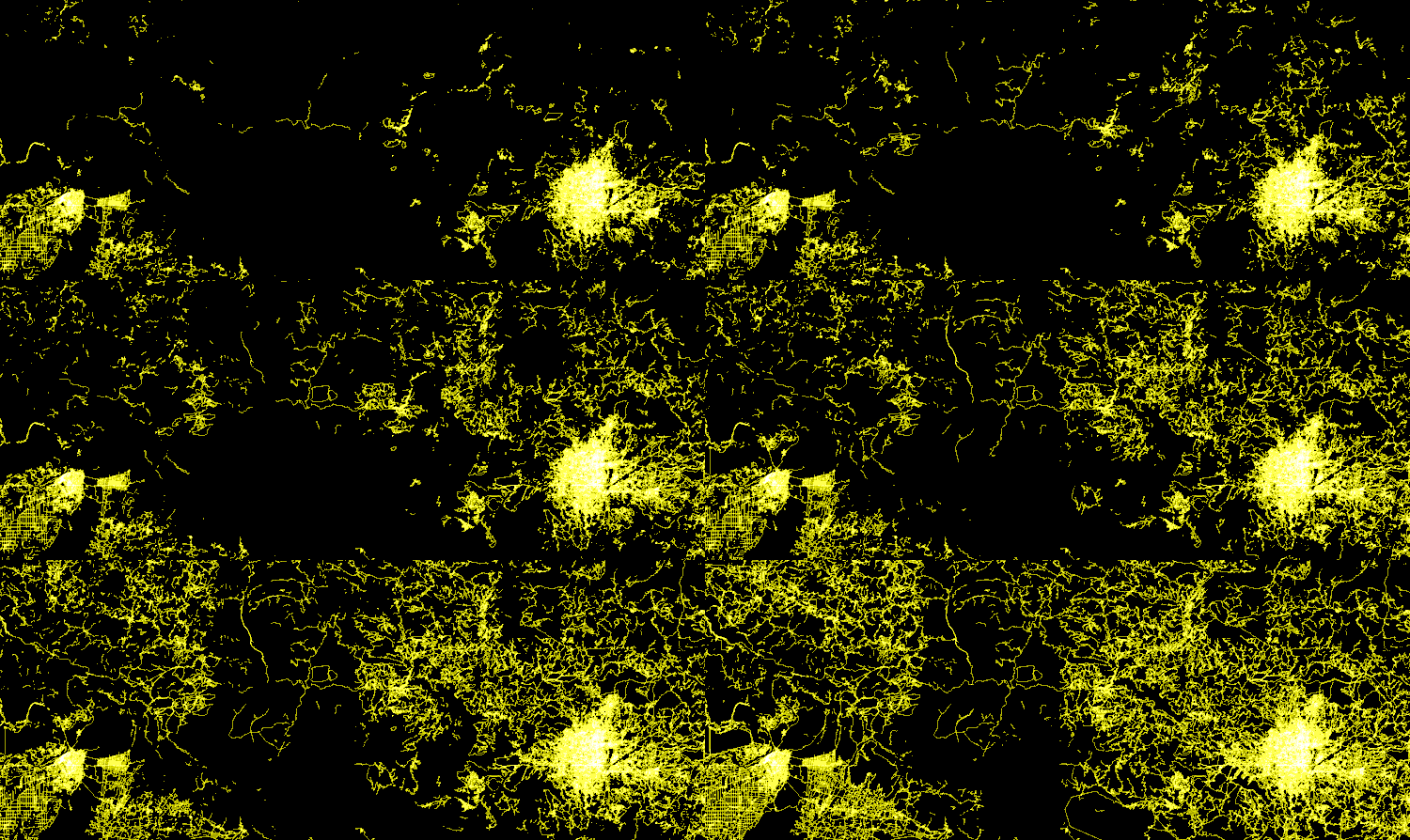
From the page: “Our goal is to contribute to humanitarian relief by rapidly providing a detailed and accurate map (i.e., road network, villages, buildings, etc.) to support the humanitarian organizations. These services help locate people at risk efficiently, and facilitate the delivery of goods and services to remote areas. OSM Tasking Manager to coordinate the mapping by the contributors.” The following image is taken from a MapBox entry providing some numbers on user contributions on OpenStreetMap in the first few days; “more than mappers have recorded 13,199 new miles of roads and 110,681 new buildings”. Open collaboration works!
New Scientific Journal: Open Geospatial Data, Software and Standards

Thanks to Between the Poles I learned about the new SpringerOpen journal named ‘Open Geospatial Data, Software and Standards’. Its content is published under a Creative Commons license (CC-BY).

The aims and scope: “Open Geospatial Data, Software and Standards provides an advanced forum for the science and technology of open data, crowdsourced information, and sensor web through the publication of reviews and regular research papers. The journal publishes articles that address issues related, but not limited to, the analysis and processing of open geo-data, standardization and interoperability of open geo-data and services, as well as applications based on open geo-data. The journal is also meant to be a space for theories, methods and applications related to crowdsourcing, volunteered geographic information, as well as Sensor Web and related topics.”

Batch geonews: LiDAR Standards Woes, Maps on Apple Watch, Esri Maps for Office 3, and much more

Here’s the recent geonews in batch mode.

On the open source / open data front:

  • Registration is open for the FOSS4G-Europe conference in Como, Italy, July 14-17
  • Anyone can now register to the FOSS4G in Seoul September 14-19
  • The OSGeo and the ISPRS signed a MoU
  • You can sign the Open Letter of the Need for Open Standards in LiDAR, open formats being threatened by Esri’s new proprietary LiDAR format, this story was also discussed over Slashdot and while Esri provided a response, it has not been judged satisfactory
  • Related to LiDAR too, US NAVY Sonar/Lidar Editing Software Released To the World
  • Slashdot discusses Getting Started Developing With OpenStreetMap Data
  • A summary of Progress on open U.S. addresses
  • New open source software, JAI-Ext, the Open Source replacement for Oracle JAI, JAI stands for Java Advanced Imaging: “The main feature of JAI is the ability to process image using deferred execution and tiling, which provide high performances when elaborating input data”
  • While Stanford University launched EarthWorks to search for geospatial data worldwide with the open source GeoBlacklight, people I talked to about it were not enthusiastic considering it’s not as standards-driven as other existing tools
  • We mentioned the Kickstarted and now it’s going to be part of QGIS 2.10, Introducing QGIS live layer effects!
  • A book Review: Building Mapping Applications with QGIS
  • A free gvSIG course, MOOC Cycle “GIS for Users”
  • Useful, A How-To Guide For Exploring 3D Buildings in Cesium
  • In recent releases, GeoServer 2.6.3 released, GeoTools 12.3 released, and PostGIS 2.0.7 & 2.1.7 Released

On the Esri front:

  • Esri offers a series on Getting to know Esri Maps for Office 3.0: Part 1 and Part 2, here’s the initial announcement Esri Maps for Office 3.0 is now available
  • Living Atlas news, Introduction to the Living Atlas Community and the Living Atlas Contributor App

On the Google front:

  • The old version of Google Maps won’t be available anymore
  • New Street View content in South Africa
  • Informative, Understanding Google’s Imagery Updates map part 3: 3D imagery
  • A developer entry on Interactive Data Layers in the JavaScript Maps API
  • Location of the sun and the moon, anywhere, Sun Surveyor brings augmented reality to photographers using Google Maps APIs
  • Affects Google Maps everywhere, Japanese Court Orders Google To Remove Negative Reviews From Google Maps
  • I’ve seen it! Myth or monster? Explore Loch Ness with Street View
  • Changes from Google retiring the old community and supporting The New Google Earth Community

Discussed over Slashdot:

  • In the UK, Ordnance Survey Releases Mapping Tools
  • Thanks in part to geospatial sensors, The Car That Knows When You’ll Get In an Accident Before You Do
  • An interesting high-level analysis of autonomous cars, going from human centric to centralized geospatial AI, Autonomous Cars and the Centralization of Driving and on the same topic, it started 20 years ago, Back To the Future: Autonomous Driving In 1995 and even Uber is at it now Uber’s Hiring Plans Show Outlines of Self-Driving Car Project and so are others Hyundai To Release “Semi-Autonomous” Car This Year and if really you want to read more, A Robo-Car Just Drove Across the Country
  • Crowdsourcing at work, How Flight Tracking Works: a Global Network of Volunteers
  • Google to provide risk maps and early warning from the Google Earth Engine platform and Microsoft to provide drones, Obama Says Climate Change Is Harming Americans’ Health
  • Snap a picture of a thing and 3D-print it, Smartphone-Enabled Replicators Are 3-5 Years Away, Caltech Professor Says
  • It’s coming, Tiny LIDAR Chip Could Add Cheap 3D Sensing to Cellphones and Tablets
  • And it’s going to be fun, Google, Developers Demo Impressive Gaming and VR Apps For Project Tango Tablet
  • But don’t forget climate change, The World Lost an Oklahoma-Sized Area of Forest In, Satellite Data Show
  • Wish I could do that, Cetaceans Able To Focus Sound For Echolocation

In the everything else category:

  • Here’s the official video on how to use maps with the Apple Watch, nothing spectacular, but expect more geoapps on smartwatches in the future, also on Apple Maps, Apple Maps Now Includes Hotel Reviews From TripAdvisor and Booking
  • If you did not know already, How to set up location-based reminder on iPhone?
  • Can’t be easier? Now you can Google where is your lost Android phone
  • Interesting to some of us, Using WMS Time to explore your data
  • Remote sensing satellites becoming more affordable, Build Your Own Satellite For Less Than $30K
  • A conference we never mentioned before, GeoAdvances In Kuala Lumpur October 28-30
  • Geospatial matters, Geospatial contributes $21 billion to the Canadian GDP
  • Free remote sensing data, SPOT and Pleiades data available for research and application development
  • Internet of Things, O’Reilly offers an informative article on What are iBeacons?
  • GeoA offers an article on Maplim – The Easiest Way to Collaborate on a Map
  • A recurrent topic, DHS Wants Access To License-plate Tracking System, Again
  • You want to monitor your child? FamilyTime App Review – One Of The Best Parental Control Apps With Advanced Geofencing

In the maps category:

  • Geopolitical maps are not descriptive, they’re prescriptive, The Flawed Standard Model of Geopolitics and the accompanying entry Final Maps on “Geopolitical Anomalies”
  • From the same source, Attempts to Map Latin America’s Political Spectrum
  • A potentially interesting book, Weaponizing Maps by Denis Wood and Joe Bryan, ‘map or be mapped’
  • I’m not certain that’s a funny point of view, there’s more Arctic sea ice in this new Canada map
  • The same source also shares New Moon Maps and Space Maps: Ceres, Mars, Exoplanets
  • Maps of How Diseases Spread worldwide
  • Are they around you? Every UFO sighting since 1933 mapped
  • xkcd map of US locations based on movie backgrounds
  • And yes again, the Mercator projection is messing with our perception of the world, After this video you’ll never trust a map again

Batch Geonews: Landsat-live and on AWS, OpenStreetMap Reaches 2M Contributors, Vector Tiles, and much more

Here’s the recent geonews in batch mode. Slashgeo has recently been a victim of a hack and was hosting some ‘commercial’ links on a hidden sub-site — nothing users would have found out unless they were directed to this parallel site by a third-party. We addressed the issue and, while it never directly impacted the Slashgeo you’re used to, I’m happy this bump is behind us.

From the open source / open data front:

  • Real success, 2 million contributors to OpenStreetMap and if you want to read a lot about OSM, here’s 489 Pages about OpenStreetMap
  • Here’s Peter Batty’s Review of FOSS4G-NA, I learned a lot in this review, including about the state of vector tiles and Leaflet development, well worth reading
  • PostGIS 2.1.6 Released, and here’s a short and to the point entry named PostgreSQL 9.5 features of interest to PostGIS Users
  • GeoTools 13.0 has been released and so was the SDI package deegree 3.3.14 released
  • The major FOSS4G conference will take place in Bonn, Germany
  • The FOSS4G-India conference has been announced for June 8-10 in Dehradun
  • QGIS:
    • Handy QGIS plugin SCP 4.3 allows for downloading from the entire archive of Landsat 4, 5, 7 and 8
    • Also a QGIS plugin of interest if time matters to you, Time Manager 1.6 – now with feature interpolation
    • Useful, Datum transformations with NTv2 grids in QGIS: the easy way
    • Yes, you can even run QGIS on Raspberry Pi 2
  • CityGML still gaining ground? Berlin 3D Portal provides CityGML data for 550,000 buildings
  • More open data, from the UK this time, New Ordnance Survey OpenMap Released

From the Esri front:

  • Vector tiles again, Mapbox Vector Tile Specification adopted by Esri
  • Time and multidimensions in ArcMap, Introducing the Dimension Explorer
  • New on ArcGIS Online, Map Gives New Insights into Global Population

From the Google front:

  • For developers, Hello Places API for Android and iOS
  • Street View everywhere!
    • River-based StreetView in Europe, Drift dreamily down the Danube
    • Discover, From sea to shining sea: A Street View tour of the U.S.
    • In India too, Zoom with a view: Visit India’s stunning monuments online
    • And Brazil, Mapping Brazilian islands, above ground and under the sea
    • And to the top of the world, Growing up in the shadow of Everest
  • Too much spare time? Pac-man PAC-Maps A new way to navigate the streets of Google Maps, April 1st is tomorrow, not today!

Discussed over Slashdot:

  • Useful UAVs, Laser Imaging Drone To Hunt Out Unexploded Bombs In War-Torn Nations
  • All the Internet anywhere, European Commission Proposes “Digital Single Market” and End To Geoblocking
  • When there’s money, Uber To Turn Into a Big Data Company By Selling Location Data
  • Postgresql and geospatial data mentioned, Michael Stonebraker Wins Turing Award
  • They’re coming, Self-Driving Car Will Make Trip From San Francisco To New York City

In the everything else category:

  • There’s now Landsat data now on Amazon Web Services, and related, Mapbox’s Landsat-live project: Maps with the most up-to-date Satellite imagery and here’s the official announcement, Landsat-live goes live
  • VerySpatial links to the Geospatial Data Reform Act introduced in US Congress
  • Privacy, right? Ars acquires 4.6M license plate scans from the cops, for Oakland
  • Given the amount of Excel users, Microsoft Power Map, How to make a killer map using Excel in under 5 minutes with PowerMap plugin
  • It isn’t surprising that it will have geospatial-related apps, ‘Citymapper’ and ‘Transit App’ Offer In-Depth Looks at Transit Experiences on Apple Watch
  • Still alive, Nokia’s HERE navigation app is back on iOS with offline maps

In the maps category:

  • Travel like a Queen, the Queen of England’s 47 maps of places you should avoid
  • Drama unfolding, Watch Arctic Ice Cover Hit a 30-Year Low
  • Spare time? DIY Beautiful Map of the World, Burned Into Scrap Wood
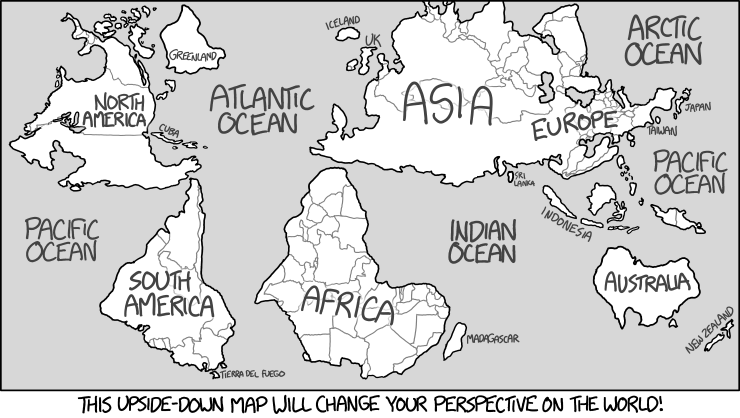
  • Let’s end with a funny xkcd interpretation of an upside-down map

GeoServer 2.7 Released

The popular open source geospatial data server GeoServer version 2.7 has been released earlier this week.

The new features highlighted in the announcement:

  • Color composition and color blending
    • These are two new extensions to the rendering engine that allows for greater control over how overlapping layers in a map are merged together
  • Relative time support in WMS/WCS
  • WPS:
    • WPS clustering
    • WPS security
    • WPS limits
    • WPS dismiss
  • CSS extension refresh
  • Cascade WFS Stored Queries