Recent Posts

Batch Geonews: 25m European DEM, OpenLayers 3 vs Google Maps API v3, GeoMedecine, and much much more

Here what's probably our latest geonews in batch mode entry, have a nice holiday break!

From the open source / open data front:

  • Boundless published a OpenLayers 3 & Google Maps API Compared
  • Python and raster data? Introducing rasterio
  • Here's an entry on the 25m European Digital Elevation Model (EU-DEM, Version 1)
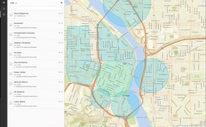
  • Much more efficient, OpenStreetMap's Redesign Goes Live! More Focused, More Inviting, More Map, and still on OSM data, Disability Mapping with OpenStreetMap
  • In updates, GeoTools 10.3 Released and GeoServer 2.4.3 Released and MapGuide Open Source 2.5.2 and MapBox.js v1.5.0
  • Beautiful, Using the 25m EU-DEM for shading OpenStreetMap layers

From the Esri front:

  • A summary of What’s New in ArcGIS Online (December)
  • Still breathing, ArcGIS 3.6 for Flex Released

From the Google front:

  • Having kids? Join Santa and his elves in the countdown to Christmas Eve
  • An entry telling you how to Create your own Street View
  • The Bing Maps architect Blaise Aguera y Arcas is joining Google
  • Google is improving maps in Building Better Maps in Brazil, Israel, and Russia
  • You might be interested by National Geographic shares rich map content with the world via Google Maps Engine
  • There's the classic, New Google Earth Imagery – December 6

In the everything-else category:

  • If you haven't heard of the GeoPackage draft standard yet, read this, OGC's Geopackage standard enables geospatial data sharing for mobile devices
  • Things do change, Open Geospatial Consortium updates its vision, mission, policies and procedures
  • A new Eye in the Sky, First Images form Skybox’s SkySat-1 Released 
  • An interesting read about How Can Geography Literacy Be So Bad At The Age Of Google Earth?
  • Wired shares an entry named 6 Reasons to Get Over Your Fear of Coding and Start Making Better Maps
  • The rise of GeoMedecine? A 10-minutes TED talk about named Your health depends on where you live
  • Apple geo-related news:
    • Geofencing to Unlock Vehicle Functions Detailed in New Apple Patent Application

    • iBeacon Technology Tapped to Unlock Location-Specific Newsstand Content on iOS Devices and ​Apple Updates Apple Store App with Support for iBeacon Systems, but Apple is far from being alone in that race,  Qualcomm Launches 'Gimbal' Bluetooth LE iBeacon Competitor

  • If you're not already convinced autonomous cars going to happen;
    • Ford Self-Driving R&D Car Tells Small Animal From Paper Bag At 200 Ft.
    • Nissan Leaf Prototype Becomes First Autonomous Car On Japanese Highways

    • Volvo Plans To Have Self-Driving Cars In Swedish City of Gothenburg By

  • Geo and privacy:
    • If there was doubts, NSA Tracking Cellphone Locations Worldwide
    • An extreme scenario, Meet Jack, or What The Government Could Do With All That Location Data
    • But there are watchdogs? FTC Drops the Hammer On Maker of Location-Sharing Flashlight App
    • and hope, Boston Police Stop Scanning Registration Plates, For Now
    • but it's really everyone, Indiana State Police Acknowledge Use of Cell Phone Tracking Device
    • and sometimes it's good, New GPS Tracking Bullet May Render High-Speed Police Chases Obsolete
  • Not that surprising, Need Directions? Might Not Want To Ask a Transit Rider
  • We heard lots about drones, now it's time for SkyJack, a hacking system taking control of drones and the discussion on the topic, How To Hijack a Drone For $400 In Less Than an Hour - talking of Drones, that's impressive Drone Footage of Bangkok Protests
  • In Canada? The new Canadian Geodetic Vertical Datum of (CGVD2013) recently launched
  • Reality surpasses fiction once again, New MIT Camera Takes 3D Photos in the Dark
  • You see, geospatial is evenin our heads! Memories Are ‘Geotagged’ With Spatial Information, Penn Researchers Say
  • Underwater, First 3D topography of Great Barrier Reef derived from EO data
  • A discussion about National GIS for India

In the maps category:

  • Wired shares Some of the Year’s Best Images of Earth From Space, nice indeed
  • Income distribution across the US, Census Bureau: Majority of Affluent Counties In Northeast US
  • Here's a long review fo the Barrington Atlas iPad App
  • Bitcoin? Coinmap – The Interactive Map Of Brick And Mortar Locations Accepting Bitcoins
  • Wow, take a look at The “underwater waterfall” of Mauritius Island

Releasing data really works, Part V

Bloggage update: It took five days (after hours) to stand up, learn, tweak and display my East Anglia Fenlands project on Mapcentia's web service. It started with a GISuser group post on LinkedIn on Monday, I used my Amazon Web Service free EC2 trial and GeoCloud2 under beta, and by Friday I had it working and styled. No small thanks to Martin Hogh's original work and help, the result is a simple yet modern and pleasing web map. Not only can I serve up the results of my round-trip Ordnance Survey polygon corrections, but I can also serve up my East Anglia Fenlands project quickly and effectively.

OGC World Weather Symbols 0.5.0 Released

Almost everything geospatial deals with symbols on maps or other types of displaying mechanism. Here's a new source of symbols coming from the OGC MetOcean DWG, the 'World Weather Symbols' available on GitHub.

It is described as "A complete set of WMO weather symbols in SVG with full metadata." It's not a version 1.0, but they are fully usable right away and there's "A set of pre-generated PNGs are available for download […]". From the same source you can get the 'World Meteorological Organization - Regional Associations' (WMO-RA) in geojson, which is vector data representing the "Six regional associations are responsible for the coordination of meteorological, hydrological and related activities within their respective Regions […]".

Other openly available geospatial-related symbols sources that I'm aware of include:

  • Maki icons - open source pixel-perfect icons for web cartography
  • Emergency Mapping Symbology - from NRCan's GeoConnections
  • GLYPHICONS - while not specifically targeting mapping, the free section is Creative Commons licensed

Any other pertinent source?

Batch Geonews: New Maki Icons, OpenStreetMap News, Ads in Your Google Maps Maps, ArcGIS Online Update Coming, and much more

Here's the recent geonews in batch mode.

From the open source / open data front:

  • Nice, there's new Maki icons - don't remember? That's open pixel-perfect icons for web cartography
  • You're into PostGIS? There's PostGIS Add-ons now, including 15 new functions
  • Everything about OpenStreetMap and Typhoon Haiyan in the Philippines, including an impressive OSM before and after comparison - collaboration and open works.
  • The OSRM - routing engine for OpenStreetMap has been updated
  • And still on the same vein, Drone Imagery for OpenStreetMap
  • There were several notable updates: MapStore 1.4.0, GeoTools 10.2, GeoServer 2.4.2 and Geopaparazzi 3.8.0

From the Esri front:

  • There's a big ArcGIS Online Update coming on December 10, here's the improvements
  • New basemap data for Denmark

From the Google front:

  • A new opt-in cleaner way to embed Google Maps in websites, the drawback is the new terms of service now allow Google to add ads, don't say you were not aware
  • New to StreetView, Take a hike with Street View through U.S. National Parks and Parks Canada
  • Via Ed, on why datums matters, a Scientific American article named What Happens to Google Maps When Tectonic Plates Move?
  • Over Slashdot they discuss a story named Google Maps, Lasers Reveal Vatican Catacombs
  • Also discussed over Slashdot, Street View floats into Venice

In the everything else category:

  • More high resolution satellite imagery coming our way, Relaxing resolution restrictions on satellite imagery, and from the same source, an interesting entry on Nanosatellites for 4D (time + 2D/3D) Earth observation
  • Nice pictures, Slashdot discusses ISS Astronauts Fire-Up Awesome 'Cubesat Cannon'
  • We mentioned it before, and now Microsoft Releases “3D Builder” Touchscreen 3DP App
  • Still on 3D, Apple is to buy Israeli 3D sensing company PrimeSense ​and here's a nice summary of How Apple Could Incorporate PrimeSense Technology Into Its Products
  • Apple also started testing iOS 7's iBeacons in retail commercial areas and a Judge Dismisses Lawsuit Over Apple's Location Tracking in iOS
  • Something we saw before, throw the camera in the air, get a 360×360 image from 36 2-megapixel lenses
  • Those working with Microsoft map tech, here's How to Extend Your App with Talking Maps
  • Privacy works both ways? Boston Cops Outraged Over Plans to Watch Their Movements Using GPS
  • In a school tracking failed, Students Tracked In UK College Via RFID For 1-3 Years
  • Tracking is omnipresent already, LoJack To Release Tracking Devices For Consumers, Insurance, and Auto Makers
  • Slashdot discusses Scientists Proposing Satellite Early Warning System For Forest Fires
  • On a similar topic, Wired has an entry named Incredible High-Resolution Interactive Map of the World’s Shrinking Forests
  • Google too have an entry named Mapping the world’s deforestation over time
  • Bicycles and GNSS navigation, Hammerhead System Offers a Better Way To Navigate While Cycling
  • There's a new MapQuest navigation app, anyone uses it and can comment?
  • VR headsets coming our way soon, The Science Behind the InfinitEye's Panoramic Virtual Reality Headset
  • Ok, this isn't something I was expecting, Smartphone + Bike + Google Maps = GPS Art

In the maps category:

  • Want to learn more on special projections, Projection Smackdown: Cahill’s Butterfly vs. the Dymaxion Map
  • Looking for special maps to give at Christmas? ODT's South Up Maps and equal area maps might interest you
  • Andrew, a regular contributor to Slashgeo, offers 30 maps around the world collected over time
  • Wired shared an entry named 5 Maps That Could Help Solve Some of the World’s Most Daunting Problems
  • Via VS, something we'll probably hear more often in the future, mapping Bitcoin
  • U.S.: do you live in the right zip-code area? The Washington Post maps America's "Super Zips"
  • Not the season, but here's Golf course maps and Mapping a golf course
  • Don't get depressed by the Global Depression Map
  • Isn't it Thanksgiving in the U.S.? A Real-Time Map of Travelers Suffering From the Thanksgiving Storm

Esri GeoFences with the New Geotrigger Service

Apple, Google and others have been offering geofencing-related services for a while, and now Esri solidifies their offer with the public beta version of Esri's Geotrigger Service.

From the official entry: "How does the Geotrigger Service work? An invisible area drawn on a map is set to have an action or message associated with it. When your mobile device crosses into the “trigger zone” the Geotrigger Service sends a location-based message to that device, or even notifies your server for custom events. […] The Geotrigger Service runs in the cloud. […] Free while in beta."