Michael W. Dobson (Ph.D) runs the TeleMapics organization. TeleMapics provides independent advice on mapping, geospatial technology and solutions for applications that use geographic information. In this interview GPS Bites spoke to him about his views on the Apple partnership with TomTom, TeleAtlas, and his predictions for GPS and mapping over the next two years. You can read the interview in full on the GPS Bites website on the link below:
Read More »Tag Archives: GPS
Twitter used to map Language Diversity in London
In another interesting project to come out of the Centre for Advanced Spatial Analysis the language of tweets in London has been mapped. To obtain the data used in the project they "captured tweets sent using GPS-enabled devices and put them through Google’s Chromium Compact Language Detector, which identified the language used".
It makes for quite an interesting visualisation. Examine the map here.
Read More »
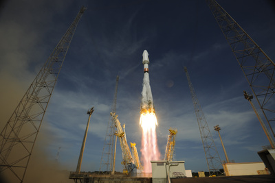
Galileo: Europe’s Version of GPS Reaches Key Phase
I learned on Slashdot from this story named Galileo: Europe's Version of GPS Reaches Key Phase.
Their summary: "The third and fourth spacecraft in Europe's satellite navigation system have gone into orbit. The pair were launched on a Russian Soyuz rocket from French Guiana. It is an important milestone for the multi-billion-euro project to create a European version of the U.S. Global Positioning System. With four satellites now in orbit — the first and second spacecraft were launched in — it becomes possible to test Galileo end-to-end. That is because a minimum of four satellites are required in the sky for a smartphone or vehicle to use their signals to calculate a positional fix."
An addition from the ESA: “By late, 18 satellites are scheduled to have been launched, by which time early services to Europeans can begin."
Of course, we regularly mentioned Galileo since.
A few unrelated bits of Geonews: GPS for Mint, JFlow for Flood Modeling and WFS for Earthquakes
The Royal Mail are trialing the use of GPS units to collect more accurate location information as way to broaden their range of income generating services:
Something of interest relating to flood modeling. The link below contains an article describing JFlow, a tool that has been used to map the the flood risk for the UK:
The following link describes WFS/WFS-T in the context of the aftermath of the Christchurch, NZ, earthquake for the distribution and update of geospatial data between different agencies:
Read More »
NAVSOP Navigation System Rivals GPS
A story discussed recently over Slashdot is named NAVSOP Navigation System Rivals GPS.
Their summary: "BAE Systems has developed a positioning solution that it claims will work even when GPS is unavailable. Its strategy is to use the collection of radio frequency signals from TV, radio and cellphone masts, even WiFi routers, to deduce a position. BAE's answer is dubbed Navigation via Signals of Opportunity (NAVSOP). It interrogates the airwaves for the ID and signal strength of local digital TV and radio signals, plus air traffic control radars, with finer grained adjustments coming from cellphone masts and WiFi routers. In any given area, the TV, radio, cellphone and radar signals tend to be at constant frequencies and power levels as they are are heavily regulated — so positions could be calculated from them. "The real beauty of NAVSOP is that the infrastructure required to make it work is already in place," says a BAE spokesman — and "software defined radio" microchips that run NAVSOP routines can easily be integrated into existing satnavs. The firm believes the technology could also work in urban concrete canyons where GPS signals cannot currently reach."
I remembered 4 years ago we mentioned eLORAN as a possible backup system for the current satellite GNSS systems.
Read More »How SatNav Maps Are Made
It was National Holiday yesterday where I live, so it explains sharing this weekend story on a Tuesday, discussed by Slashdot: How Satnav Maps Are Made.
Their summary: ""PC Pro has a feature revealing how the world's biggest satnav firms create their maps. Nokia's Navteq, for example, has a huge database of almost 24 million miles of road across the globe. For each mile of road there are multiple data points, and for each of those positions, more than 280 road attributes. The maps are generated from public data and driver feedback, not to mention its own fleet of cars with 360-degree cameras on the top.There's an IMU (inertial measurement unit) for monitoring the pitch of the road, and the very latest in 3D surface-scanning technology too. This light detection and ranging (LIDAR) detector captures 1.3 million three-dimensional data points every second, mapping the world around Navteq's field vehicles in true 3D. The feature also investigates whether commercial mapping firms will be replaced by open-source maps." That last line makes me think of the difference between conventionally published encyclopedias and Wikipedia; "replaced by" is an odd standard in a big marketplace of ideas."
Read More »Batch Geonews: Stats on Mobile Maps, OpenLayers 3 News, Fantasy Maps, and some more
Here's the recent geonews in batch mode.
On the open source front:
- Wonder where OpenLayers 3 is heading?
- ImageI/O-Ext 1.1.4 was released
- Here's a short entry on creating hillshades with gdaldem
In the miscellaneous category:
- O'Reilly links to a few interesting stats on mobile maps in the context of Apple Maps vs Google Maps, including "In the US, Google gets about 31 million users a month on its Maps app on iOS. On average those users spend more than 75 minutes apiece in the app each month." and "90% of all iOS users used the Google Maps app at least once during April. Only 71% of Android users used the Google Maps app."
- Slashdot discussed a story named Chuck Schumer Tells Apple and Google To "Curb Your Spy Planes", referring to the new high-resolution imagery coming later this year to Apple Maps and Google Maps
In the maps category:
- TMR shares an entry on fantasy maps, with the book 'Here be dragons' by Stefan Ekman
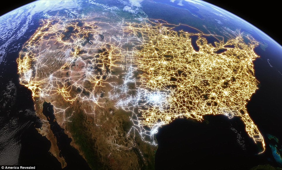
- Via O'Reilly, I stumbled onto the Art of GPS article which shares beautiful GPS-related visualizations, here's the U.S. electricity network
Read More »
Batch Geonews: GeoPublisher and AtlasStyler 1.9, Ten Things about GPS, MapInfo Pro 11.5, and some more
Here's the recent geonews in batch mode.
From the open source front:
- Along with new versions, here's the Geopublisher and AtlasStyler 1.9 release notes
From the Google front:
- Slashdot discusses a story named After Modifications, Google Street View Approved For Switzerland
- There was an imagery update on June 11th
Directions Mag articles:
- An article named My Top 6 Takeaways from SQL Server Spatial
- Another one named Ten Things You Need to Know About GPS, reminding us that often people use the GPS term while they really should use GNSS
- Another one named Intergraph’s GIS Product Roadmap Comes Into Focus
- And for Pitney Bowes, New Features for MapInfo Professional Version 11.5, and by the way, Facebook Is Using Pitney Bowes Software for Geocoding
In the miscellaneous category:
- MacRumors summarizes the U.S. Location Privacy Protection Act
- MapQuest released an all new MapQuest for iPhone app
- Rumors that Microsoft is Going 100% with Nokia Mapping in Windows Phone 8
- After Google, Microsoft jumps in the Augmented Reality future with rumored AR glasses for Xbox
- Slashdot discussed a story named 64 Drone Bases Located On American Soil
In the maps category:
- O'Reilly shared a map of global BitTorrent usage
OpenCPN 3.0 GPS Navigation Released for Linux, MS Windows, and Mac OSX
OpenCPN Version 3.0.0 Release
ANNOUNCEMENT:
OpenCPN Version 3.0 is released, and available for immediate download.
The version is a major feature upgrade and maintenance release of OpenCPN.
OpenCPN is a free and OpenSource navigation package running on Windows, Linux, and Macintosh computers.
Some features of OpenCPN include:
- Quilted Raster(RNC) and Vector(ENC) digital chart display
- Industry standard GPS receiver interfacing, with "moving map" on-screen vessel tracking.
- AIS receiver interfacing with configurable target safety monitoring
- Integrated Route, Track, and Waypoint database, with industry standard Import/Export capabilities
- Tide and Current prediction, with on-screen overlay of predicted data.
- Broad International Language support
OpenCPN is designed to be easy to install, configure, and use daily.
OpenCPN may be freely downloaded and installed without cost, registration, or time limits.
New and Enhanced Features for OpenCPN Version 3.0
1. OpenGL support, for enhanced graphics performance and functionality.
2. Improved ENC object Query interface
3. Portable execution option, allowing easy migration to new systems.
4. Upgrade to wxWidgets 2.8.12.
5. Support ENC Overlay cells.
6. Upgrade gpsd support to Version 2.96
7. Implement enhanced PlugIn system, enabling a wide variety of PlugIn types.
8. Implement DSC and GPS_Gate Buddy tracking.
9. Implement user defined Chart Groups.
10. Implement AIS SART transponder display and tracking.
11. Improved ENC object rendering and display.
12. Implement user definable Tide/Current datasets.
13. Full conformance for all platforms, especially including Macintosh OS X.
14. Greatly improved stability on all platforms, as a result of extended Beta testing.
15. Many, many improvements in the basic User Interface, while maintaining the ease-of-use that OpenCPN is widely known for.
Extended Release Notes for OpenCPN Version 3.0 may be found at
We hope you enjoy the new features of OpenCPN Version 3.0, and look forward to your continued feedback.
Download OpenCPN Version 3.0 at
For PlugIns and other useful information, visit our support website at
The OpenCPN Development Team
Dave Register, Lead Developer
__________________
Batch Geonews: ArcGIS 10.1, Bing Maps using Nokia, GeoPDF, GPS Camera Banned in China, Zombie Geography, India RISAT-1, FearSquare, and more
Here's the recent geonews in batch mode, covering the last few weeks (which have been crazy to me).
From the Esri front:
- Mandown reminds us that ArcGIS 10.1 is coming this June and the ArcGIS 10.0 SP5 is coming in July
- You can access and edit Esri maps even on the Kindle Fire
From the Microsoft front:
- Microsoft announced that Bing Maps is now using Nokia backend services for Traffic and Geocoding
- There's an official entry named Integrating Bing Maps With WPF
- And there's new Bird’s Eye Imagery & Streetside Coverage on Bing Maps
Discussed over Slashdot:
- Russian Satellite Takes Most Detailed 121-Megapixel Image of Earth Yet
- DEA Wants To Install License Plate Scanners and Retain Data for Two Years
- Senator Seeks More Info On DOJ Location Tracking Practices
- Modeling People and Places With Internet Photo Collections
- NASA's Interactive Flood Maps
- LightSquared Files For Bankruptcy
Directions Mag articles:
- Here's about what’s new in both the software and the use of GeoPDF
- Another one named Can Geofeedia Provide Location-based Citizen Input to Journalists?
In the miscellaneous category:
- An interesting Ogle Earth entry named Why do Panasonic, Leica, FujiFilm, Samsung and Nikon censor their GPS cameras?, short answer: China laws
- Learning Geography skills through a Zombie Apocalypse Narrative?, yes, nothing less
- While I found nothing surprising in there, it's still interesting to read the United Nations Five to Ten Year Vision on Geospatial Information Management (via)
- We heard this before, New Report Warns About Decline in U.S. Earth Observation Capabilities
- Meanwhile, India launched its first EO satellite, RISAT-1, with SAR capabilities
In the maps category:
- Strange Maps shares a map of Population by Latitude and Population by Longitude
- TMR shares a map of U.S. Life Expectancy by County
- It was submitted as a press release but deserves more attention, UrbMet, interactive web map for the urban metabolism of cities, the same tool was later featured on the O'Reilly Radar
- Here's Climascope, an interactive web map to explore climate change
- The Earth is mostly (70%) covered by water, but there isn't that much in terms of volume
- Mapperz mentions MapofLife, mapping geographic distributions for any terrestrial vertebrate species
- At the other end of the spectrum, FearSquare, crime around you (UK only)
Ah... it feels good to be current on geonews once again!
Read More »