Recent Posts

Going Open-Source with Esri

You didn't misread, that's the name of an official Esri blog entry, Going Open-Source with Esri.

From the entry: "We’ve also been a big supporter of the open-source community, providing code and sponsorships for efforts relevant to the users of our system. Popular tools such as GDAL/OGR, PostgreSQL, Dojo, MongoDB, and others have all been actively supported by Esri. We are embarking on a new set of initiatives to subtly change from contributing to the various open communities to being more active members of these communities. […]

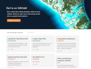
The software that we are publishing as open-source cuts across many domains – not just the web. There are mobile phone libraries and applications, desktop extensions, big data analytis tools, and of course many web application templates in ActionScript, Java and JavaScript. Right now there are nearly 50 repositories at github, and we have a lot more that we are getting ready to release. […] You can see my slides on Github."

New Open Source Software to Manage Heritage Places released - Input Wanted

The Getty Conservation Institute and the World Monuments Fund are working together to create a new open source software purpose built to help inventory and manage heritage places.

Called Arches, the software incorporates a broad range of international standards and meets a critical need in terms of gathering, making accessible and preserving key information about cultural heritage.

The project is open sourcing an early version of the alpha software code, and those interested can download it, try it out, and we would welcome their feedback.

This is the initial first phase – the software won’t be widely available until later this summer after feedback from people in the field.

Batch Geonews: Voxel.js Minecraft-like, QGIS for Android, Side-by-Side Router, and much more

Here's the recent geonews in batch mode.

On the open source front:

  • 3D and open source with WebGL mixed with games gives you Voxel.js: Minecraft-like Browser-Based Games, But Open Source, which can certainly be reused for other geospatial projects
  • Never mentioned here before, an QGIS for Android in development, and on a similar topic, QGIS Globe works again
  • OpenStreetMap's new editor named iD gets a new home and updates, ideditor
  • After last year's success, NASA launches second International Space Apps Challenge, open data and open source
  • MapBox-related news:
    • Of course, MapBox Maps Now Embed On Twitter
    • You can now embed MapBox interactive maps in Apple iBooks Author software
    • An entry on Using Google Fusion Tables to Add Real-Time Feeds to MapBox Maps

On the Esri front:

  • The ArcGIS Online World Topographic Map first updates

On the Google front:

  • A nice Side-by-Side Router, allowing you to see directions for driving, transit, bicycling and walking on a same map
  • You can learn a bit more, Details of Google's Project Glass Revealed In FCC Report

In the miscellaneous category:

  • Microsoft shares a Bing Maps for Windows Store Apps Training Kit
  • And if developing for iOS, Apple Reaches Out to LBS Developers with iOS 6.1 POI Search API
  • Pretty interesting on the future of 3D photography, Light Field Photography Is the New Path To 3-D
  • Not the first time we hear about similar protections, In Brazil, Trees To Call For Help If Illegally Felled
  • Satellites (including footprints) and iPad / iPhone: New iOS app to view the SES Astra satellite info
  • I did not know that February 2nd is World Wetlands Day
  • Interesting on the Future U.S. Workforce for Geospatial Intelligence, the world needs need more geospatial experts
  • Which is also true considering 95% of of Public Safety Agencies Under-utilize Computer Mapping and GIS
  • A topic we discussed recently, Analytics for people, the next big thing in retail
  • If you have an interest in check-ins, 500 Million Foursquare Check-ins Visualized

In the maps category:

  • A different kind of map, Swiss Historical Maps Allow Journey Through Time In Your Browser
  • Map of the Geography of Abortion Access in the US
  • On the geography of languages, here's entries named World Maps of Language Families, World Maps of Language Families, Continued, and Remaining Language Families and Geographical Language Groups
  • Let's close this batch mode edition by another funny xkcd on mapping

Mediawiki GeoData Extension: A New Age of Geotagging on Wikipedia

This is important if you consider the immense popularity of Wikipedia, its engine Mediawiki, and the related Wikimedia Foundation projects, including the new Wikidata and Wikivoyage. Here's the blog entry named GeoData: a new age of geotagging on Wikipedia.

From the entry: "Today, we present the GeoData extension for MediaWiki, which now provides a structured way to store geo-coordinates for articles, as well as an API to make queries around this information. […] Coordinates added to articles are now stored separately in the database, as opposed to being stored arbitrarily in wiki markup. This makes it easy to query the coordinates of a particular page or a list of pages around a given set of coordinates. The Solr search engine is used for spatial queries, making the searches extremely fast. All the functionality is also available via the API, allowing developers to create tools that use this data."

Driverless Cars Are Worth Trillions Poll Results and New Poll on Public Perception of Geospatial

Here's the results our latest poll on driverless cars. Out of 89 participants, 22% answered it won't happen or at least won't happen in their lifetime. That leaves out 30% believing the technology is almost ripe, 19% see driverless cars only on safe route, and 28% go to the point where insurance companies won't allow humans to drive anymore.

Those 78% of optimists seeing driverless cars happening are not alone. Forbes shares a 3-parts article named Fasten Your Seatbelts: Google's Driverless Car Is Worth Trillions: "Driverless car technology has the very real potential to save millions from death and injury and eliminate hundreds of billions of dollars of costs. Google’s claims for the car, as described by Sebastian Thrun, its lead developer, are:

  1. We can reduce traffic accidents by 90%.
  2. We can reduce wasted commute time and energy by 90%.
  3. We can reduce the number of cars by 90%."

Part 3 of the article claims that this will happen much sooner than most think, Another article from the O'Reilly Radar is titled The driverless-car liability question gets ahead of itself.

The new poll we offer you asks Does the public realize the omnipresence and importance of geospatial technologies?, as much as we can guess what's in "the public's mind". Is was directly influenced by the recent story named Mapping Creates Jobs and Drives Global Economic Growth.