Recent Posts

Launch of India’s First Navigation Satellite Successful

Slashdot reports on the successful launch of India's First Navigation Satellite. We mentioned India's GNSS interests.

Their summary: ""India's first dedicated navigation satellite, the IRNSS-1A, developed by the Indian Space Research Organization, was successfully put in orbit on Monday night. The launch vehicle, PSLV-C22, bearing the 1,425-kg navigation satellite, blasted off the launch pad at the Satish Dhawan Space Center here at the scheduled lift-off time of 11.41 p.m." The satellite is the first of seven that will eventually provide a regional equivalent of GPS under complete Indian control."


Leaflet 0.6.2 Released

A week ago the popular Leaflet version 0.6.2 was released, this comes about 5 months after version 0.5.

From the announcement: "0.6 highlights include nicer controls, lots of interaction usability improvements, many new API methods, events and options, ability to save layers as GeoJSON, much better test infrastructure and TONS of bugfixes that made Leaflet significantly more reliable. Checkout the huge detailed list of changes (120+ total!) in the changelog. The API reference was also updated to reflect all these changes. […] On a related note, even GitHub itself is now using Leaflet for GeoJSON visualizations, along with Leaflet.markercluster & MapBox tiles!"

Another related entry is the Leaflet Plugin Authoring Guide.

Two pieces of Geonews - what3words and Lidar used at Angkor Wat

Just thought I'd share a couple of stories I've read recently that are geo related.

The first is a short report on the use of Lidar at Angkor Wat. The use of this technology has apparently discovered previously unknown buildings and other urban arterfacts.

Secondly is an article describing the what3words app:

"A new app has divided the globe into 57 trillion 3m by 3m squares and labelled each area with just three words. The what3words app has assigned each square a simple three word address to help make finding locations more accurate and memorable"

pycsw 1.6.0 released

The  pycsw  team  announces  the  release  of  pycsw  1.6.0.
The  1.6.0  release  brings  numerous  features,  enhancements  and  fixes  to  the  codebase,  including:
  *  Nabble  community  forum  now  available  via  OSGeo
  *  fix  broken  connection  in  pycsw.admin.optimize_db
  *  native  PostGIS  geometry  support
  *  new  community  section  on  website
  *  Web  Accessible  Folder  (WAF)  harvesting  support
  *  added  spatial  ranking  for  spatial  queries
  *  added  lxml  3  support
  *  fixes  for  new  OGC  CITE  tests
  *  added  support  for  SOS  2.0.0  harvesting
  *  added  support  for  SOS  1.0.0  harvesting
  *  added  database  specific  unit  tests
  *  added  support  for  nested  OGC  Filter  queries
  *  fixed  ISO  output/safeguarding  extent  elements
  *  fixed  parameterization  of  OGC  Filter  queries
  *  fixed  fulltext  search  to  dump  only  XML  element  values
  *  added  flexibility  to  pycsw.admin.setup_db  to  handle  use  cases  from  calling  applications,  like  specifying  extra  columns,  skipping  SFSQL  setup,  etc.
  *  added  support  for  ISO  19115-2  (gmi)  harvesting
  *  FGDC,  Atom,  and  DIF  are  now  core  supported  outputschema  formats,  and  do  not  need  to  be  explicitly  set  in  configuration
  *  added  CIDR  notation  support  for  CSW  transactions
  *  enhanced  link  support  when  harvesting  OWS  endpoints
  *  fix  tighten  Dublin  Core  writer  when  checking  on  dumping  XML
  *  fixed  harvesting  logic  for  unsupported  typenames
  *  fixed  GetRecords  typename  handling  to  _not_  behave  like  a  record  filter,  but  as  a  query  model
  *  harvesting  support  for  RDF  Dublin  Core
  *  fixed  Harvest  operation  parameter  checks  in  HTTP  GET  mode
  *  added  timeout  flag  to  pycsw-admin.py  post_xml  command
  *  continuous  integration  testing  (using  travis-ci)
  *  modular  Python  logging  capability
  *  paver  implementation  for  developer  tasks
The  full  list  of  enhancements  and  bug  fixes  is  available 
This  release  also  moves  pycsw  forward  as  an  OSGeo  project  in  incubation.
pycsw  is  an  OGC  CSW  server  implementation  written  in  Python.
pycsw  fully  implements  the  OpenGIS  Catalogue  Service  Implementation  Specification  [Catalogue  Service  for  the  Web].  Initial  development  started  in   (more  formally  announced  in ).  The  project  is  certified  OGC  Compliant,  and  is  an  OGC  Reference  Implementation.
pycsw  allows  for  the  publishing  and  discovery  of  geospatial  metadata.  Existing  repositories  of  geospatial  metadata  can  also  be  exposed  via  OGC:CSW  2.0.2,  providing  a  standards-based  metadata  and  catalogue  component  of  spatial  data  infrastructures.
pycsw  is  Open  Source,  released  under  an  MIT  license,  and  runs  on  all  major  platforms  (Windows,  Linux,  Mac  OS  X).
Source  and  binary  downloads:
----------------------------------------

Testers  and  developers  are  welcome.
The  pycsw  developer  team.

ARKYD Crowdfunding Satellites and CubeSat

[It's Summertime! I'm on holiday this week and will share more geonews next week]

We mentioned DIY remote sensing imagery before, now it went in a new direction with a successful Kickstarter crowdfunding for the ARKYD telescope. Here's the direct link to the ARKYD Kickstarter project dubbed "a space telescope for everyone" which gathered over 1M$ and there's still 4 days for you to contribute to get your own pictures from space.

The Slashdot summary: "Most of you know about Planetary Resources, the asteroid mining company, and their Kickstarter campaign in the finest spirit of Heinlein's The Man Who Sold the Moon. The campaign has reached its minimum $1M goal to get funded with eight days left to go. In celebration, PR's CEO and Chief Asteroid Miner Chris Lewicki does an interview with Forbes where he discusses the future opportunities, the potential pitfalls, and the unlimited potential of private sector space exploitation. It's well worth the read. Planetary Resources' kickstarter has some worthy stretch goals that are well worth looking at, and the sort of supporter premiums that many Slashdotters will not want to miss. Only $175,000 more and they get a second ground station, at $2M they add exoplanet search capability. Both of these stretch goals are within reach."

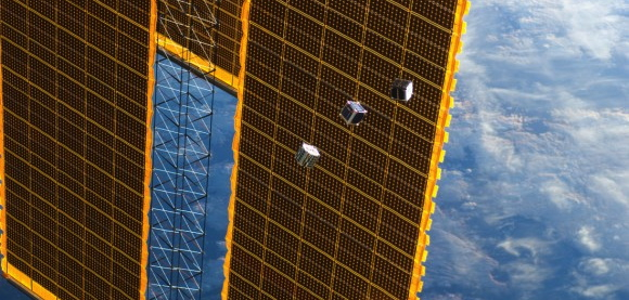
Another similar story recently discussed over Slashdot is named CubeSats Spurring Satellite Revolution.

The Slashdot summary: "Thanks to the miniaturization of electronics, small CubeSat satellites have quickly become the standard for orbital Earth monitoring. Their modular design and lower cost makes them accessible to many, from university researchers to backers of crowdfunding campaigns. This year, the number of CubeSats launched will at least double the number in orbit to date."