Tag Archives: ArcGIS

Batch Geonews: OSGeo Annual Report, Cloud-Offloaded GPS, Contact Lenses AR, Geojobs Shortage, and much more

Quite a few interesting news in this batch mode edition.

From the open source front:

  • It was the first time I heard about the open source LSI Viewer, an online Shapefile viewer
  • There's the new MapProxy 1.5.0 released
  • And Portable GIS is now at version 3.1
  • It is also the first time we mention GisClient, "an open source software written in AJAX, Javascript, PHP/MapScript that offers an innovative way to manage complex GIS projects. The main strength in it is that allows to configure a big range of tools and functionalities easily and quickly."
  • If you're working with the U.S. Federal government, take a look at FedGeo Day, to be held in Washington DC on February 28, here's the official website
  • Here's the MapBox New Features Roundup
  • Regarding QGIS, visualising QGIS data in 3D with Blender and on Sharing QGIS Symbols
  • Here's the just released OSGeo Annual Report
  • A bugfix, PostGIS 2.0.2 has been released
  • And there's the call for papers and new website for FOSS4G, in the U.K. this year
  • The open source ArcGIS for Local Government Apps Available Now on GitHub

From the Google front:

  • Google announced two new features for the Google Places API: Place Photos and Radar Search.
  • Google wants us to know that they're listening to our Google Maps feedback
  • The GEB shares links for The making of the "Powers of Ten", the 1977 video
  • The GEB also reports that Botswana not happy with Google Street View, since it "compromise their security"

In the miscellaneous category:

  • APB informs us about cloud-offloaded GPS (CO-GPS) to decrease power needed by GPS devices
  • DM reports that the National Geologic Map Database Gets a Face Lift
  • We now have drones that can infect with software virus other drones
  • Here's an OGC summary of Location Business Summit USA
  • Augmented reality to the extreme, Belgian Researchers Build LCD Contact Lenses
  • Extending their offer, MapBox Teams Up with DigitalGlobe on Satellite Imagery
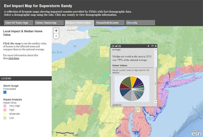
  • Here's the ArcGIS Online World Topographic Map December updates, and also Esri-related, Esri Updates Terms of Use on (Free) Personal Accounts for ArcGIS Online
  • On geospatial jobs, APB shares two interesting entries; NZ Report on Geospatial Skill Shortage and Four of Eight Emerging Careers for Demand Geospatial Skills

in the maps category:

  • Here's an entry named Using Series of Maps to Represent Changes in Time: How Diabetes Swept the U.S.
  • VerySpatial links to an entry and map on the geography of US charity
  • Let's end this issue with a fake map on procrasti-nation

Read More »

SCALGO introduces new software packages

SCALGO has reorganized its software packages portfolio, while also introducing significant new functionality, such that the portfolio now includes software packages SCALGO Model, SCALGO Topology, SCALGO Hydrology and SCALGO Utility. The software packages have successfully been used to process terrain data sets with more than 50 billion data elements on a normal desktop computer.

SCALGO Model is used to construct raster and TIN terrain models from massive terrain points. SCALGO Topology can be used to analyze and simplify the topology of massive raster terrain models, and SCALGO Hydrology contains tools to perform basic hydrological modeling on massive raster terrain models. SCALGO Utility can be used for efficient manipulation and conversion of massive terrain and point data sets.

All SCALGO software can be run through a standalone graphical user-interface or from within ArcGIS and also include an ArcGIS viewer that allows for easy visualization of the output of many of the SCALGO modules.

Information about SCALGO technology, products and services can be found. Future information about SCALGO products and services can also be received directly through Twitter and Facebook.

Illustration showing a section of the result of computing the volume of depressions (including depressions inside depressions) using the SCALGO Topology Depression Mapping module on a high-resolution 13000km² raster terrain model. Each cell in a depression is marked with the volume of the depression below the cell. In this figure green cells have high volume, yellow cells medium volume and red cells very low volume. The map can be used in a rough risk assessment where the value in each cell indicates the volume of water that needs to flow to the depression before the cell is under water. The raster elevation model has been hydrological conditioned using the SCALGO Utility Burn module to add buildings and cut bridges and the SCALGO Topology Topological Simplification module was used to remove spurious depressions. The figure also shows the river network as computed by the SCALGO Hydrology Flow Accumulation module.

Scalable Algorithmics (SCALGO) was founded in with the mission to bring cutting-edge massive terrain data processing technology to market. The SCALGO technology is based on more than two decades of basic and applied research on I/O-efficient and geometric algorithms at Center for Massive Data Algorithmics (MADALGO) at Aarhus University in Denmark and at Duke University in the US, in collaboration with industry LiDAR and environmental GIS application experts. Software based on the technology can handle much larger terrain data sets on a normal desktop than most current software and thus it eliminates the need for accuracy-decreasing data thinning. The use of novel mathematical and algorithmic techniques also means that the software works provably efficient on all input data sets, delivering a completely specified output without the use of cumbersome workflows such as those introduced by data tiling. SCALGO is involved in multiple research projects and offer special pricing for academic institutions. SCALGO also offers special non-commercial pricing for national, regional and local governments.

Read More »

Batch Geonews: JS.geo Conference, ArcMap2SLD, MapQuest Discover, GLONASS Corruption, and much more

Here's the latest batch-mode edition of the geonews.

From the open source front:

  • InaSAFE 1.0 launched, it's a "free software that produces realistic natural hazard impact scenarios for better planning, preparedness and response activities", it's also a QGIS plugin

From the Esri front:

  • Interested by the SLD standard? Here's about converting an ArcMap project file into an SLD document with ArcMap2SLD
  • Here's how to add access to various formats to ArcGIS using GDAL/OGR
  • Here's How to build an Apple Map app for iOS using the ArcGIS Runtime SDK for iOS

From the Google front:

  • Google reminds us to let indoor Google Maps be your guide this holiday shopping season
  • There were Big updates to Google Mars
  • There's also Google Earth Outreach in Australia and New Zealand now

In the miscellaneous category:

  • Bill Gates writes about GIS, GPS and maps, Digital Mapping Technology Helps Polio Vaccinators Zero In
  • Here's another must-read entry on the GIS crisis from Brian Timoney, arguing that (Domain Experience + GIS)   >   (GIS + domain experience)
  • James tells us about the upcoming JS.geo Geospatial JavaScript conference in Denver January 14-15, attendance is also only 10$
  • Another story on Secret Stingray Warrantless Cellphone Tracking
  • GLONASS corruption exposed and 200M$ stolen, GLONASS Satellite System Designer Fired
  • An Apple Maps consequence; Scott Forstall Reportedly Forced Out of Apple
  • A few news from MapQuest, New MapQuest Gas Prices App and MapQuest for iPhone with Traffic-Influenced Directions, and they also introduced MapQuest Discover, a new MapQuest Local, and more: "a photo-centric social and travel experience centered on places that people may want to explore"
  • Geospatial isn't just for driverless cars, Motorcycle App Helps You Ride Faster, Turn Sharper, Brake Harder
  • We already know about drones, More Drones Set To Use US Air Space
  • An article on Taking the 'Pulse' of Volcanoes Using Satellite Images
  • Meet the World's First 3D Printing Photo Booth and on that topic, How to print a 3D Google Earth building using Makerbot
  • APB provides Bentley Systems by the Numbers
  • Apparently, U.S. Weather Satellites Are Dying
  • Here's a different 3D game, where you learn about the effects of the speed of light (via ORR)
  • Here's a generic article on how web mapping is helping government improve communications and services

And finally, at the suggestion of a Slashgeo user which made a donation, we added a 'Paypal button' to ease the process of making donation to Slashgeo.

Read More »

Esri News: ArcGIS on Windows 8, ArcGIS App Now in Windows Store, Business Analyst 10.1 + iPad App, Map Stories, and more

Here's recent Esri-related news.

  • Yes, with the latest service pack, ArcGIS 10.1 runs on Windows 8 
  • The latest SP also brings 64-bit Geoprocessing
  • Esri shares several entries on map stories in Esri tools:
    • Be a hero in 15 minutes with story map templates (screenshot below)
    • Story Maps
    • Getting Started with Story Map Templates
  • Here's what's new in Business Analyst 10.1
  • There's a New Business Analyst iPad App too
  • And you're not confined to iOS, the ArcGIS app is now available in the Windows Store
  • ArcGIS for Local Government Fall is now available
  • Silverlight isn't dead yet? ArcGIS Viewer for Silverlight 3.0 released

Read More »

Batch Geonews: SotM US, GIS Interview Questions, Verizon Tracks Customers, U.S. Election Map, and much more

Here's the recent geonews in batch mode.

On the open source / open data front:

  • Here's an excellent summary of OpenStreetMap's State Of The Map US -, on Steve Coast's presentation, Dr JTS shared: "He said that the top thing OSM needs to continue to grow is addressing.  He singled out Google Mapmaker as being a clear and present danger to the growth of OSM."
  • James shows us how to easily download OpenStreetMap data from WeoGeo
  • There's a new Open Source Geospatial Research and Education Lab established at North Carolina State University
  • MediaGoblin, an open YouTube, Flickr and the like competitor, now supports 3D models
  • If you're interested by the uDig desktop GIS, there's now video tutorials
  • You can publish maps direction from ArcGIS to MapBox Publishing with Arc2Earth Sync
  • There's even more and updated OpenStreetMap tiles offered by MapQuest
  • Here's how to create dynamic contour maps with server-side processing with WPS, GeoServer and PostGIS 2.0
  • GeoServer 2.2.1 has been released

On the Esri front:

  • Using ArcGIS Online? There's a the ArcGIS Online Health Dashboard, to let you know if any service is down

On the Google front:

  • The GEB tells us about Tracking KMZ file usage with Google Analytics
  • Here's an entry on Trekking the Grand Canyon for Google Maps, for Street View of course

On the Microsoft front:

  • The ridiculous patent war continues, Microsoft Sues Motorola Over Mapping Patents
  • A U.S. State identification game for MS MapPoint

Geo-related Slashdot discussions:

  • I had to happen, Apple Maps Accidentally Reveals Secret Military Base In Taiwan
  • Remote sensing helped monitor a Huge Geoengineering Project Violates UN Rules on Canada's west coast
  • An Arctic Investigation Underway Into Solar Storm Sat-Nav Disruption
  • We'll probably see this often, Texas Schools Using Electronic Chips To Track Students; Parents In Uproar
  • Implementing geospatial isn't always easy, Uber [mobile app] Gives Up On New York Taxi Service
  • Privacy is dead right? How Hair Can be Used To Track Where You've Been
  • Reusability, NASA Working On Refueling Satellites

In the everything else category:

  • Using Verizon? They sell where you are; Verizon Sells App Use, Browsing Habits, Location (via O'R)
  • DM shares an article named Prepare to Get That Job: 20 Challenging GIS Interview Questions, and also related to jobs, GeoSearch Tracks U.S. Geospatial Employment in Q3
  • Drones for geospatial? Home-made 3D-Printed Drones (via O'R)
  • The promise of WebGL, while this article isn't specifically on geospatial uses of WebGL, it's worth taking a look at the WebGL demonstration video (wait at least until colors kick in, after about one minute)
  • Fearing supervolcanos? For those in South America, ESA's story on the 'sombrero uplift' seen by remote sensing, the largest active magma body in Earth's continental crust
  • Geospatial brings value? A DM article on Location Intelligence unlocks the power of your data

In the maps category:

  • Good timing, United Swing States of America: Presidential Election Battle Map
  • Several readers might be interested by North American Cartographic Information Society's Atlas of Design, now available
  • APB reports on that the UK Met Crime Map is Overwhelming for Users
Read More »

SCALGO Hydrology 1.2 Released

SCALGO has released version 1.2 of the software package SCALGO Hydrology, which can be used to perform basic hydrological modeling on massive raster terrain models (containing tens of billions of cells) on a normal desktop computer.

The new version contains a number of new features that make it easier to perform large-area hydrological analysis. These features include handling of massive collections of polygon data, which e.g. allows for easy and efficient "burning" of a large number of features (such as buildings, bridges and culverts) that are important for hydrological modeling into a large-area terrain model. The release also includes functionality that allows for efficient computation of various measures (height, area, volume) of all depressions (including depressions inside other depressions) in massive raster terrain models, which e.g. allows for easy and efficient identification of the depressions and terrain areas most important for hydrological modeling.

As the previous version, all SCALGO Hydrology 1.2 modules can be run through a standalone graphical user-interface or from within ArcGIS. In SCALGO Hydrology 1.2 the newly released ArcGIS version 10.1 is supported and an ArcGIS viewer has been added that allows for easy visualization of the output of many of the package modules.

The new release also contains updates to the standalone user-interface and to some of the core algorithms, including the utilization of multiple CPU cores. Overall, the most significant updates in SCALGO Hydrology 1.2 include:

  • Extension to the Bluespot module so that each bluespot cell contains the measure (height, area or volume) of the depression below the cell.
  • New Clip module that clips a raster or a point cloud according to a set of polygons.
  • New Burn module that burns elevation values from a set of polygons into a raster or a point cloud.
  • New Calculate module that evaluates a function for each cell in a raster.
  • New Masks module that generates binary masks from a raster (e.g. useful for post-processing Sea-Levels module output).
  • Merge of TIN Conversion, Raster Conversion and Point Conversion into new Convert module.
  • Addition of multi-core support in many core algorithms.
  • Updated standalone user-interface, including options to monitor CPU, disk and memory use.
  • Addition of ArcGIS viewer for visualizing the output from many of the package modules.
  • Support for ArcGIS 10.1.


Information about SCALGO technology, products and services can be found. Future information about SCALGO products and services can also be received directly through Twitter and Facebook.

Scalable Algorithmics (SCALGO) was founded in with the mission to bring cutting-edge massive terrain data processing technology to market. The SCALGO technology is based on more than two decades of basic and applied research on I/O-efficient and geometric algorithms at Center for Massive Data Algorithmics (MADALGO) at Aarhus University in Denmark and at Duke University in the US, in collaboration with industry LiDAR and environmental GIS application experts. Software based on the technology can handle much larger terrain data sets on a normal desktop than most current software and thus it eliminates the need for accuracy-decreasing data thinning. The use of novel mathematical and algorithmic techniques also means that the software works provably efficient on all input data sets, delivering a completely specified output without the use of cumbersome workflows such as those introduced by data tiling. SCALGO is involved in multiple research projects and offer special pricing for academic institutions.


llustration showing the result of computing bluespots using SCALGO Hydrology 1.2, visualized using the SCALGO ArcGIS Viewer.

Illustration showing the result of computing bluespots using SCALGO Hydrology 1.2, visualized using the SCALGO ArcGIS Viewer. A cell is colored blue if the volume of the depression in the terrain below the cell is at most 3236m³ (as set by the viewer threshold value). Prior to the bluespot computation, the SCALGO Hydrology 1.2 Burn module was used to add buildings and cut bridges in the terrain model covering more than 13000km².

Read More »

Batch Geonews: Shapefiles in Bing Maps, 80% of Data is Not Spatial?, In-Location Alliance, ArcGIS for AutoCAD 300, and much more

This is my tentative to catch up the geonews since my mid-August holidays. Here they are!

On the open source / open data front:

  • UDig 1.3.2 has been released with several new features and supports Axios spatial editing tools again
  • Since the USGS provides the Landsat archive, but this entry mentions that a substantial part of the Landsat archive is available on the fast and reliable public Google Earth Engine cloud storage

On the Esri front:

  • The free plugin ArcGIS for AutoCAD version 300 is now available
  • There's now an ArcGIS Runtime for iOS for ArcGIS WebMaps

On the Google front:

  • Google made a few Google Maps announcements, including voice guided directions in India, Map Maker in New Zealand and new Street View in 150 university campuses
  • In another entry, Google offers a roundup of their August Google Maps related news, most news we already shared with our users
  • Nothing surprising, new imagery released on September 1

On the Microsoft front:

  • Microsoft shares an entry on overlaying Esri shapefiles in BIng Maps
  • Microsoft's Global Ortho Project is complete for the United States, meaning there's high resolution 30cm imagery everywhere in the country
  • There's a new Bing Get Me There App for iOS for London, UK
  • An entry on Bing Maps V7 AJAX Highlights

In the everything else category:

  • James shares a must-read short entry named '80% of Data Is Not Spatial So Stop Claiming It Is', read the comments for insights
  • Here's a pertinent entry related to a UN paper, Criticism - Future Trends in Geospatial Information Management: The Five to Ten Year Vision
  • Here's an update on the OGC standards and the semantic web (aka Linked Data)
  • APB informs us that 22 companies formed the In-Location Alliance to Enhance Indoor Positioning
  • O'Reilly links to an article on Yelp Checkins to Measure Geopositioning Accuracy Across Phones
  • Slashdot discuss the Location Privacy Act Approved By California Legislature
  • Other stories at Slashdot, The Rapid Rise of License Plate Readers and UK License Plate Cameras Have "Gaps In Coverage"
  • Big numbers, APB indicates that the GIS market will soon reach between 3.7 - 10.6 Billions, depending on who you ask

In the maps category:

  • On APoD, there's a pretty interesting map of hurricane and tropical storms paths (screenshot below)
  • An interesting map of the Global Decline in Religiosity
  • Some London Olympics maps: The politics of London Olympic medal counts

Read More »

Esri News: Yearly Q&A, Summaries for the Esri International User Conference, Productivity Improvements, and more

Here's the recent Esri-related geonews. Last week was the Esri International User Conference, we already mentioned the launch of Esri Maps for Microsoft Office.

  • Prior to the conference, Esri shared a very long list of Q&A: "We do this every year to keep you informed on our efforts in software development, products, education, and support; future plans in these areas; and thoughts on GIS and the industry as a whole." Since the document is very long, APB graciously shared a useful entry named Digging into the Esri UC Q & A. James took the challenge of providing funny answers.
  • The Esri UC Plenary Session Videos are already available
  • Mandown provided several related entries:
    • The Top 10 Productivity Improvements In ArcGIS 10.1, the first 3: Sharing, Improved Server Functionality and Performance Improvements
    • Esri And Microsoft To Provide Online Maps And Applications During Disasters
    • ArcGIS For Local Government 10.1 Now Available
  • Directions Magazine also share several related entries:
    • A list of pre-conference summits links
    • Nokia Location & Commerce and Esri completed a deal for Location Intelligence
    • An APB entry named ArcGIS Online is Not the Answer to Every Question, James has a related entry I still don't know what ArcGIS Online is
    • An informative entry named Takeaways from Esri UC
    • Here's a summary of Dangermond on Executives Empowering Executives
  • It was published as a press release (but it's not one), information on the Advanced Utility Network Analyst (AUNA) extension
Read More »

Advanced Utility Network Analyst

Advanced Utility Network Analyst (AUNA) is an extension for ESRI Utility Network Analyst tracing toolbar, Create, save and publish trace tasks with no code at all.

You can watch a full video about the tool here

I subscribed to the private beta but I still didn't recieve the download.


Read More »

Batch Geonews: iD OpenStreetMap Editor, GeoIQ Acquired by Esri, Predicting People’s Location, and more

Here's the recent geonews in batch mode.

On the open source and open data front:

  • This entry introduces iD, a new open source friendly editor for OpenStreetMap, which uses only javascript (no plugin required like Potlatch)
  • If you want to try a full-featured OpenStreetMap maps display, try this version by skobbler
  • Here's what's coming to the next QGIS: Better date and time support in QGIS expressions and styles
  • Here's an entry on MapGuide Open Source scalability
  • In Canada, the Province of Quebec now has its open data portal, a lot of it being geospatial [site in French]

On the Esri front:

  • Big news, GeoIQ, which runs GeoCommons, has been acquired by Esri, several bloggers see this move as a reduction of competition, from GeoIQ: "GeoCommons and GeoIQ customers will continue to be supported as we integrate the capabilities of ArcGIS Online and GeoIQ into a next generation platform."
  • The ArcGIS 10 Service Pack 5 is now available

In the drones category:

  • UAS can stay in the air for a long period of time now, Slashdot discussed a story named Laser Powers Lockheed Martin's Stalker Drone For 48 Hours
  • However, another story goes like this; GPS Spoofing Attack Hacks Drones

In the car navigation category:

  • Slashdot discussed a story named Ford Predicts Self-Driving, Traffic-Reducing Cars By
  • And another one named Boston Using IBM Engineers To Solve Traffic Problems

In the everything else category:

  • Certainly using the momentum against Google that is limiting the free use of their Google Maps API, MapQuest shared an entry named Unlimited Free Maps with MapQuest API Community Edition, and whle they do use OpenStreetMap data, MapQuest selected TomTom Maps to power its mobile application
  • Direction Mag offers an Overview of Pitney Bowes Software’s Server and Web Technology for Geospatial Applications
  • Slashdot discussed a story named MIT Develops Holographic, Glasses-Free 3D TV
  • Still want more on Google's Project Glass before it hits the road? Sergey Brin Shows Project Glass Glasses to Journalists (Video)
  • APB shares an entry named Algorithm Uses Your and Friends Locations to Predict Your Future Location (within 20 meters!)
  • James shares an short entry named Autodesk on the Future of Design
  • APB links to the top world cities to live in, based on the Spatially Adjusted Livability Index

In the maps category:

  • Ogle Earth has detailed entries named Apple censors iPad Maps app over South Korea and Constraining online maps: The case of South Korea
  • It's hot over there? Here's a map of continental US climate changes, 1895-2012
  • Two related entries, Renewable Electricity Production Mapped and Mapping Renewable Electricity Generation
  • Here's Misleading Language Maps on the Internet and from the same source, Mapping International Languages
  • Here's a map of Global Earthquakes since 1898
Read More »