Tag Archives: QGIS

Batch Geonews: 89% Use Google Maps, New Google Maps UI and iPad app Available, Esri UC Round Up, and much more

Here's the recent geonews in batch mode. Several interesting bits in there that may have deserved a full entry, but it's Summer time and I'm on holidays :-)

On the open source / open data front:

  • Remember Maki, the open / free cartography symbols? Maki got significantly improved and even gets an API
  • Announced, OpenGeo dives deeper into QGIS, along with the OpenGeo Suite 3.1 release
  • Jody shares his experience on OSGeo and LocationTech software foundations and their different cultures
  • Getting closer, OpenLayers 3.0.0-alpha.3
  • A success story in the Netherlands, Open standards open source projects for sharing geodata among provinces saves €4.5 million
  • A book review of 'Interactive Map designs with Leaflet JS Library How-to' by Jonathan Derrough

On the Esri front:

  • Lots of Esri news in the Round Up of Directions Magazine Esri UC Coverage 
  • A popular template, Map Tour story map template updates
  • James goes on with ArcGIS for Minecraft this time
  • Overview for Using the power of Amazon EC2 to build ArcGIS Server map caches

On the Google front:

  • Bang! 89% of websites that use mapping technologies use Google, while that may not be the exact figure, it does mean something
  • The new Google Maps interface is available to all, but you still have to opt-in, it's *really* an improvement
  • I'm amongst the happy ones, The new Google Maps app for iPhone and iPad is here
  • This goes along with the SDK version 1.4, Street View, indoor maps, and an updated map design in the Google Maps SDK for iOS
  • Jumping in, Google joins LocationTech
  • Indoor mapping everywhere, Where are we going to eat? See inside before you decide!
  • New places, On top of Mt. Fuji with the Street View Trekker and Scaling the heights of the Eiffel Tower
  • Still on a parallel track of OpenStreetMap, Growing the Google Map Maker community in Europe
  • And today, there is new imagery again

Geonews discussed over Slashdot:

  • Cheer up, Spatial Ability a Predictor of Creativity In Science
  • Another one, Disney Algorithm Builds High-Res 3D Models From Ordinary Photos
  • 3D printing for the masses, eBay Dips Toes Into 3-D Printing Market With iOS App
  • In case your weren't certain, U.S. DOJ: We Don't Need a Warrant To Track You
  • If you have a car, you can be tracked, "Smart Plates" Could Betray California Drivers' Privacy
  • And why not, ACLU Study Says Police Cameras Create Database of Our Movements
  • But some good news, Texas School District Drops Embattled RFID Student IDs; Opts For Cameras
  • Unsurprisingly, New Android Eyewear Wants To Compete With Google Glass
  • We mentioned what3words before, and now over Slashdot, Describe Any Location On Earth In 3 Words
  • What's in an Interactive Nukemap, Now In 3D

In the miscellaneous category:

  • Exposing online devices, Shodan lets you search and find the physical locations of online devices
  • On Apple, Apple Acquires Locationary to Address Location-based Big Data and Acquires HopStop for public transit  ... and according to Slate,  Apple's Maps Strategy Is Working Just Fine
  • An interesting discussion on mapping millions of dots and making great maps out of it
  • Via OR, an architecture book and design book named Operative Design: A catalogue of spatial verbs
  • OR shares a interesting quote: "We’re all carrying little networked laboratories in our pockets. You see a photo. I see millions of light-sensor readings at an exact coordinate on the earth’s surface with a time resolution down to the millisecond. The future is combining all these signals into new ways of understanding the world, like this real-time stream of atmospheric measurements."
  • BIM is there to stay? 71% of AEC professionals in annual UK survey see BIM as the future and Widespread adoption of BIM by national governments

In the maps category:

  • This was a hot topic in the U.S. recently, Mapping the Trayvon Martin murder case
  • Maps of Global Patterns of Tobacco-Related Economic Issues and another one on tobacco consumption
  • O'Reilly shares an Interactive map: bike movements in New York City and Washington, D.C.
Read More »

Batch Geonews: Stamen Map Stack, 1,000 New Street View, Protest Maptivism, D3.js Geo, 270TB of Bird’s Eye, and much more

Here's the recent geonews in batch mode.

From the open source / open data front:

  • Here's an excellent and funny presentation of Leaflet: Past, Present and Future
  • GitHub just added mapping capabilities: any GeoJSON file hosted on GitHub can be mapped with MapBox Streets 
  • Mapnik 2.2.0 has been released
  • Here's CLAVIN (Cartographic Location And Vicinity INdexer) is an open source software package for document geotagging and geoparsing that employs context-based geographic entity resolution (via O'Reilly Radar)
  • A new book available, The QGIS Training Manual, by Rüdiger Thiede, Tim Sutton, Horst Düster, and Marcelle Sutton
  • Here comes QGIS Enterprise, it's QGIS Desktop + Server + Web Client along with support and maintenance contract
  • Yes, in QGIS 2.0 we'll get data-defined symbol properties, and here's on the new QGIS 2.0 APIs
  • Mapbender has been resurrected into Mapbender3: "the back office software and client framework for spatial data infrastructures" 
  • Something new, GeoThink.ca - Canadian Geospatial and Open Data Think Tank
  • Here's some nice javascript examples dealing with projections and other geostuff, mostly from D3.js, some are pretty impressive
  • Here's all OpenGeo presentations videos from FOSS4G-NA, and why not, here's the GeoServer presentation from GeoSolutions
  • About the same time, OpenGeo also launched MapMeter, a monitoring tool for spatial deployments such as GeoServer
  • From the gvSIG blog, I learned about available Emergency mapping symbology

From the Esri front:

  • An entry named From ArcMap to ArcGIS Online: well-prepared geographic information for the web
  • Here's the OGC summary of what happened with the GeoServices REST API standard submitted by Esri
  • There's now ArcGIS Online admin tools available on GitHub
  • News that Esri looks to link CAD Software to ArcGIS Online

From the Google front:

  • Google announced today nothing less than 1,000 new Street View locations to Google Maps
  • Road traffic information is important to Google, Google To Buy Waze For $1.3 Billion and the official Google announcement
  • There was a Google ocean bathymetry update earlier this week
  • Wonder what Google Glasses looks like inside? Via Make, here's What's Inside Google Glass
  • That's a topic we mentioned before, recently discussed over Slashdot, How Google Street View Keeps an Eye on Things Where There Are No Streets
  • A book's voyage recreated in Google Earth: “Sailing Alone Around the World” in Google Earth
  • I tried the new Google Maps interface, and I admit, this is an excellent improvement

In the miscellaneous category:

  • Via APB, the well known Stamen Design launched their Map Stack that makes designing maps free, easy and fun
  • APB links to an article named The Revolution Will Be Live-Mapped: A Brief History of Protest Maptivism
  • In case you missed it, Landsat 8 data is available for download since May 30th
  • Earlier this week, Microsoft announced 270 terabytes of new Bird's Eye imagery
  • Geoff mentions that the Time required to create 3D city models dropping rapidly, now less than a week for a textured 3D model of a whole city
  • Google Glass will have competition, Atheer Offers a Wearable Display That's Glasses, Not Glass, but it's clearly not as sexy or wearable
  • In Apple's iOS new 'Today' feature, there's Traffic Information on Frequently Visited Locations
  • A quick one on 3D printing, "Anti-Gravity" 3D Printer Sculpts Shapes On Any Surface
  • A generic article on drones / UAVs gathering location-based science data easier and cheaper than ever
  • And now those drones can be accurately guided by thoughts 
  • Frank at VerySpatial offers a long entry on the geography of cars
  • The same site made me aware of the course on Teaching World Music with Geospatial Technology

In the maps category:

  • Here's 5 Maps That Show How Divided America Really Is: median income, poverty line, inequality, food stamps, and diplomas
  • Here's a Map of All American Rivers
  • Funny name, WWF's ArkGIS: mapping the changing Arctic landscape
  • Here's bedmap2, an ice and bedrock map Antarctica
Read More »

Batch Geonews: Voxel.js Minecraft-like, QGIS for Android, Side-by-Side Router, and much more

Here's the recent geonews in batch mode.

On the open source front:

  • 3D and open source with WebGL mixed with games gives you Voxel.js: Minecraft-like Browser-Based Games, But Open Source, which can certainly be reused for other geospatial projects
  • Never mentioned here before, an QGIS for Android in development, and on a similar topic, QGIS Globe works again
  • OpenStreetMap's new editor named iD gets a new home and updates, ideditor
  • After last year's success, NASA launches second International Space Apps Challenge, open data and open source
  • MapBox-related news:
    • Of course, MapBox Maps Now Embed On Twitter
    • You can now embed MapBox interactive maps in Apple iBooks Author software
    • An entry on Using Google Fusion Tables to Add Real-Time Feeds to MapBox Maps

On the Esri front:

  • The ArcGIS Online World Topographic Map first updates

On the Google front:

  • A nice Side-by-Side Router, allowing you to see directions for driving, transit, bicycling and walking on a same map
  • You can learn a bit more, Details of Google's Project Glass Revealed In FCC Report

In the miscellaneous category:

  • Microsoft shares a Bing Maps for Windows Store Apps Training Kit
  • And if developing for iOS, Apple Reaches Out to LBS Developers with iOS 6.1 POI Search API
  • Pretty interesting on the future of 3D photography, Light Field Photography Is the New Path To 3-D
  • Not the first time we hear about similar protections, In Brazil, Trees To Call For Help If Illegally Felled
  • Satellites (including footprints) and iPad / iPhone: New iOS app to view the SES Astra satellite info
  • I did not know that February 2nd is World Wetlands Day
  • Interesting on the Future U.S. Workforce for Geospatial Intelligence, the world needs need more geospatial experts
  • Which is also true considering 95% of of Public Safety Agencies Under-utilize Computer Mapping and GIS
  • A topic we discussed recently, Analytics for people, the next big thing in retail
  • If you have an interest in check-ins, 500 Million Foursquare Check-ins Visualized

In the maps category:

  • A different kind of map, Swiss Historical Maps Allow Journey Through Time In Your Browser
  • Map of the Geography of Abortion Access in the US
  • On the geography of languages, here's entries named World Maps of Language Families, World Maps of Language Families, Continued, and Remaining Language Families and Geographical Language Groups
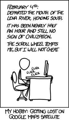
  • Let's close this batch mode edition by another funny xkcd on mapping

Read More »

Batch Geonews: Landsat 5 Decommissioned, GeoPackage RFC, Geocoding Client API in GDAL/OGR, Drone Stories, and much more

This is an abnormally long version of our 'batch geonews' edition, covering the news since the holiday break.

On the open source & open data front:

  • This entry discusses the new geocoding client API in GDAL/OGR
  • Good news, QGIS gets built-in Oracle support, along with New QGIS PDF and HTML manuals and New QGIS Symbol Packages
  • James informs us on the GeoPackage Comment Period is Open, GeoPackage what? Read this previous entry named OGC Draft GeoPackage Specification - Finally the Shapefile Format Replacement?
  • James is also enthusiastic about D3.js for its map visualization capabilities
  • More in the useful chaining Rendering Transformations in GeoServer
  • In case you missed the press releases, GeoTools 8.5 released and GeoServer 2.2.3 released
  • Freely available course named Java Open Source GIS Development - From the building block to extending an existing GIS application
  • Here's an entry on using PgRouting with Mapserver

On the Esri front:

  • The ArcGIS API for JavaScript Version 3.3 Released

In the miscellaneous category:

  • It's really the end now, mission accomplished, Landsat 5 will be decommissioned (via VS)
  • Follow this link if you have an interest in 30+ years of LAI and FAPAR data for Your research use
  • Microsoft shares an entry on Getting started with Bing Maps Windows Store Apps
  • Here's an interesting top 10, Top 10 Spatial Law and Policy Stories from
  • DM shares an article named Intergraph Retools, Revamps Entire Geospatial Product Suite
  • Beidou, aka as Compass, China’s GNSS, is now available for Commercial Use in Asia
  • O'Reilly discusses the inevitability of smart dust, where geospatial-aware sensors are to be found everywhere
  • Here's geospatial studies of atmospheric lead as a dangerous pollutant
  • Here's a funny xkcd cartoon on 'simplifying' map directions

A bunch of minor geo-related stories discussed over Slashdot:

  • Nice use of drones: Drone Photos Lead to Indictment For Texas Polluters
  • Also on drones: Researchers Seek to Use Drones For Brushfire Forecasting
  • A real-time map of those bushfires was up: Australia Is On So Much Fire, You Can See It From Orbit
  • Remote sensing satellites in jeopardy thanks to the fiscal cliff: Going Off the Fiscal Cliff Could Mean Missing the Next Hurricane Sandy
  • Slashdot just discovered OpenFlights, which we mentioned years ago: Visualizing Personal Flight Data With OpenFlights
  • Benefits and inconveniences of being tracked: Disney Wants To Track You With RFID
  • Also on RFID: Texas High School Student Loses Lawsuit Challenging RFID Tracking Requirement and Texas State Rep. Files 2 Bills To Ban RFID In Schools

In the maps category:

  • Pretty interesting map, one that more or less works both upside down and... upside up! (screenshot below)

Batch Geonews: OSGeo Annual Report, Cloud-Offloaded GPS, Contact Lenses AR, Geojobs Shortage, and much more

Quite a few interesting news in this batch mode edition.

From the open source front:

  • It was the first time I heard about the open source LSI Viewer, an online Shapefile viewer
  • There's the new MapProxy 1.5.0 released
  • And Portable GIS is now at version 3.1
  • It is also the first time we mention GisClient, "an open source software written in AJAX, Javascript, PHP/MapScript that offers an innovative way to manage complex GIS projects. The main strength in it is that allows to configure a big range of tools and functionalities easily and quickly."
  • If you're working with the U.S. Federal government, take a look at FedGeo Day, to be held in Washington DC on February 28, here's the official website
  • Here's the MapBox New Features Roundup
  • Regarding QGIS, visualising QGIS data in 3D with Blender and on Sharing QGIS Symbols
  • Here's the just released OSGeo Annual Report
  • A bugfix, PostGIS 2.0.2 has been released
  • And there's the call for papers and new website for FOSS4G, in the U.K. this year
  • The open source ArcGIS for Local Government Apps Available Now on GitHub

From the Google front:

  • Google announced two new features for the Google Places API: Place Photos and Radar Search.
  • Google wants us to know that they're listening to our Google Maps feedback
  • The GEB shares links for The making of the "Powers of Ten", the 1977 video
  • The GEB also reports that Botswana not happy with Google Street View, since it "compromise their security"

In the miscellaneous category:

  • APB informs us about cloud-offloaded GPS (CO-GPS) to decrease power needed by GPS devices
  • DM reports that the National Geologic Map Database Gets a Face Lift
  • We now have drones that can infect with software virus other drones
  • Here's an OGC summary of Location Business Summit USA
  • Augmented reality to the extreme, Belgian Researchers Build LCD Contact Lenses
  • Extending their offer, MapBox Teams Up with DigitalGlobe on Satellite Imagery
  • Here's the ArcGIS Online World Topographic Map December updates, and also Esri-related, Esri Updates Terms of Use on (Free) Personal Accounts for ArcGIS Online
  • On geospatial jobs, APB shares two interesting entries; NZ Report on Geospatial Skill Shortage and Four of Eight Emerging Careers for Demand Geospatial Skills

in the maps category:

  • Here's an entry named Using Series of Maps to Represent Changes in Time: How Diabetes Swept the U.S.
  • VerySpatial links to an entry and map on the geography of US charity
  • Let's end this issue with a fake map on procrasti-nation

Read More »

Batch Geonews: JS.geo Conference, ArcMap2SLD, MapQuest Discover, GLONASS Corruption, and much more

Here's the latest batch-mode edition of the geonews.

From the open source front:

  • InaSAFE 1.0 launched, it's a "free software that produces realistic natural hazard impact scenarios for better planning, preparedness and response activities", it's also a QGIS plugin

From the Esri front:

  • Interested by the SLD standard? Here's about converting an ArcMap project file into an SLD document with ArcMap2SLD
  • Here's how to add access to various formats to ArcGIS using GDAL/OGR
  • Here's How to build an Apple Map app for iOS using the ArcGIS Runtime SDK for iOS

From the Google front:

  • Google reminds us to let indoor Google Maps be your guide this holiday shopping season
  • There were Big updates to Google Mars
  • There's also Google Earth Outreach in Australia and New Zealand now

In the miscellaneous category:

  • Bill Gates writes about GIS, GPS and maps, Digital Mapping Technology Helps Polio Vaccinators Zero In
  • Here's another must-read entry on the GIS crisis from Brian Timoney, arguing that (Domain Experience + GIS)   >   (GIS + domain experience)
  • James tells us about the upcoming JS.geo Geospatial JavaScript conference in Denver January 14-15, attendance is also only 10$
  • Another story on Secret Stingray Warrantless Cellphone Tracking
  • GLONASS corruption exposed and 200M$ stolen, GLONASS Satellite System Designer Fired
  • An Apple Maps consequence; Scott Forstall Reportedly Forced Out of Apple
  • A few news from MapQuest, New MapQuest Gas Prices App and MapQuest for iPhone with Traffic-Influenced Directions, and they also introduced MapQuest Discover, a new MapQuest Local, and more: "a photo-centric social and travel experience centered on places that people may want to explore"
  • Geospatial isn't just for driverless cars, Motorcycle App Helps You Ride Faster, Turn Sharper, Brake Harder
  • We already know about drones, More Drones Set To Use US Air Space
  • An article on Taking the 'Pulse' of Volcanoes Using Satellite Images
  • Meet the World's First 3D Printing Photo Booth and on that topic, How to print a 3D Google Earth building using Makerbot
  • APB provides Bentley Systems by the Numbers
  • Apparently, U.S. Weather Satellites Are Dying
  • Here's a different 3D game, where you learn about the effects of the speed of light (via ORR)
  • Here's a generic article on how web mapping is helping government improve communications and services

And finally, at the suggestion of a Slashgeo user which made a donation, we added a 'Paypal button' to ease the process of making donation to Slashgeo.

Read More »

Open Source Geonews: Learn CartoCSS, States of GeoServer and GeoTools, ArcGIS vs QGIS Clipping, and more

Here's the recent open source geonews.

  • Geoff anticipates the next step in the evolution of open source geospatial software will be corporate engagement
  • MapBox offers you to learn CartoCSS and compositing by customizing Geography Class and the open source TileMill
  • We more about why the need for OpenLayers 3.0 to be developed
  • Many of you will probably be interested by the State of GeoServer and State of GeoTools presentations, related, GeoTools 8.3 has been released
  • Here's some partial results on the ArcGIS vs QGIS etc Clipping Contest Rematch revisited
  • Via this upcoming introductory course for accessing it using open source software, I learned about WELD, USGS's Web-Enabled Landsat Data products
  • You can open MODIS tiles directly in QGIS
  • Here's how to add layers to GeoServer using the REST API
  • If you have anything to do with New Zealand, head to this mapping New Zealand summary, which extensively uses open source
  • This year, the Sol Katz Award has been attributed to Prof. Venkatesh Raghavan
Read More »

Batch Geonews: shp.js, QMap, SPOT 6, Google Ground Truth Project, and much more

Here's the recent geonews in batch mode.

From the open source / data front:

  • MapBrief claim that the battle for open source in the enterprise in behind us, from the WSJ: "[...] for reasons including ease of innovation and cutting the time to get products to market"
  • Interesting, announcing QMap: A simple data collection application using QGIS
  • Unless I'm mistaken, we haven't mentioned yet the new 'shp.js' open source javascript Shapefile parser (via GGD)
  • In case you missed it in our PR section, there's an Education version of gvSIG
  • GeoTools 8.1 has been released, mostly a bug fix release
  • Portable GIS version 3 has been released too
  • Here's a summary of State of the Map held in Tokyo
  • It's done, OpenStreetMap data license is now ODbL
  • And yes, some crazy people try to sell open source geospatial code

From the Esri front:

  • Here's What’s New in ArcGIS Online for September

From the Microsoft front:

  • New imagery to Bing Maps, a lot of it, Global Ortho & 17 Million SqKm of New Satellite Imagery

From the Google front:

  • Plenty of geoblogs mentioned the Atlantic article on the secretive Ground Truth program in an article named How Google Builds Its Maps—and What It Means for the Future of Everything
  • Google shares a breakout of Google Maps search terms by country for this Summer
  • They also have an entry on the need to save the elephants and how to do it the geospatial way
  • You can also Explore the Forefront of Japanese Space Science with Google Maps
  • Here's the official entry on the latest imagery update in Google Maps and Google Earth, a lot of it
  • The GEB shares an entry on Viewing city lights in Google Earth and why not, another entry on Google Earth Fractals

Interesting Directions Mag articles:

  • Does Your Local Government Need A Drone?
  • New Spatial Information Act for Australia
  • Trucking Fleets Leverage Traffic Data to Work Smarter, Cut Costs
  • New Resources for GIS Job Seekers

In the miscellaneous category:

  • The SPOT 6 satellite is alive and well with its first images, it was successfully launched on September 9 and has a spatial resolution of 1.5m
  • LizardTech (MrSID) Releases Express Server 8

In the maps category:

  • Via APB, here's a Map the World’s Friendships from Facebook and Stamen
  • Here's a gigantic 3D map of the deaths in Grand Canyon
  • NASA wants you to help map an asteroid
Read More »

Open Source Geonews: Esri Diving into Open Source, India Launches Open Data Portal, Open Transit, MySQL vs PostGIS, and more

Still catching up my August holidays, here's the recent geospatial open source and open data geonews.

In general news:

  • O'Reilly publishes an article named With new maps and apps, the case for open transit gets stronger: "There’s no reason why important civic infrastructure should get bound up in a fight between Apple and Google. And in communities with public GTFS, it won’t."
  • Esri published an update on their relation with open source: "Esri has always hosted open code and samples in a variety of ways, but more can be done. Focus and motivation needs to be improved, and Esri is now making it a priority to improve its open source participation. More of Esri’s code should and will be open sourced in the coming days, weeks, months, and years." They are also on Github now.
  • sxdf
  • India launched the beta of their open data portal
  • MapQuest have a New Geocoding Service and Updated APIs Based on Open Data
  • OpenGeo shares an article named Haitidata: using open source geospatial for disaster response planning
  • FOSS4G software getting adopted, gvSIG 1.11 now official part of the standard software portfolio in the City of Munich and Luxembourg using open source GIS for cadastre
  • DM shares a 2-parts article named Designing an Open Source Geospatial Solution to Manage Airport Noise and Operations
  • For the curious ones, here's the new OSGeo Board and Charter members refreshed

In software news:

  • The OSGeo-Live 6.0 GIS software collection has been released
  • A serious OpenLayers competitor, Leaflet 0.4 has been released, actually, they're at version 0.4.3 now
  • Believe it or not, MySQL inches closer to PostGIS with support of true spatial relationship functions
  • Here's a short entry on Surface Interpolation in GeoServer and there's a new release, v 1.4.3, of GeoServer-Manager
  • Nathan is enthusiastic about Five new awesomely awesome QGIS features, here's more on the Latest Style User Interface Improvements
  • There's a new winGRASS 7 with R-integration
  • Where's MapGuide Open Source? Here's MapGuide state of the union address (or: Results of the user/developer survey)

Batch Geonews: London Olympics Maps and more, Project Geo, MapPoint, Global Arms Trade, and much more

Here's the recent geonews in batch mode.

On the London Olympics:

  • Here's on the development of the London SuperMap
  • Microsoft shares Olympics bird's eye imagery and maps
  • Esri shares Olympics thematic maps on ArcGIS Online
  • In another entry, Using Esri Data to Find the Next Olympians – Part 1
  • DM shares links to other London Olympics maps
  • APB mentions telecommunication issues in an entry named Use of Twitter, Social Media Blamed for GPS Data Delay used in Olympic Bike Race Reporting

On the open source front:

  • If you're into vertical datums, VDatum 2.3.5 has been released (via Kurt)
  • OpenGeo tells us how Thematic map creation with SLD is now much easier with the new Recode, Categorize, and Interpolate functions support in GeoServer
  • New to QGIS, HTML map tips in QGIS

On the Esri front:

  • Here's GeoMobile for ArcGIS Online - A Free Mobile GIS App for Tablets
  • The Esri Map Book, Volume 27 now available
  • The Esri Ocean basemap color style available for download

On the Google front:

  • Google Map Maker is now available in Australia (and so is OpenStreetMap ;-)
  • Planned NYC subway changes are now in Google Maps
  • We now get the Kennedy Space Center in Street View for its 50th birthday
  • The iconic residence of the UK Prime Minister, Take a virtual walk in Downing Street
  • Via O'Reilly, strange images where 3d maps and aerial imagery don’t match up
  • Using Google Earth, GE Teach to receive a Geographic Excellence in Media Award
  • And there was an imagery update for 25 cities and 72 countries

On the Microsoft front:

  • Microsoft announced MapPoint Released
  • There's Expanded UK Transit Directions

A few geostories discussed over Slashdot:

  • US Census Bureau Offers Public API For Data Apps
  • ACLU Questions Privacy of License Plate Scanners
  • The Future of Project Glass (see our current related poll in the right-hand side column)
  • Defcon Researchers Build Tool To Track the Planes of the Rich and Famous
  • Detecting moving objects, Researchers Turn Home Wi-Fi Router Into Spy Device

In the everything else category:

  • The GEB mentions Project Geo, a new Google Plus Hangout web series dedicated to increasing awareness of Geospatial Technology, industry best practices, and GIS resources
  • The eoPortal wants us to know that their Events, Images and Job Opportunities sections are now updated and online

In the maps category:

  • Here's a really nice visualization of global arms trade
  • Here's a map of Melting and Mining in Greenland
  • Maps on the Global Geography of Coffee, Tea, and Yerba Mate
Read More »