Recent Posts

CLAVIN (Cartographic Location And Vicinity INdexer) Version 1.0 Released

We mentioned the project before, and via APB I learned that the open source CLAVIN has released its version 1.0.

From the official page: "CLAVIN (Cartographic Location And Vicinity INdexer) is an award-winning open source software package for document geotagging and geoparsing that employs context-based geographic entity resolution. It extracts location names from unstructured text and resolves them against a gazetteer to produce data-rich geographic entities. CLAVIN does not simply "look up" location names – it uses intelligent heuristics to identify exactly which "Springfield" (for example) was intended by the author, based on the context of the document. CLAVIN also employs fuzzy search to handle incorrectly-spelled location names, and it recognizes alternative names (e.g., "Ivory Coast" and "Côte d'Ivoire") as referring to the same geographic entity. By enriching text documents with structured geo data, CLAVIN enables hierarchical geospatial search and advanced geospatial analytics on unstructured data."
Releasing geodata really works, Part IV

Bloggage update: Over a year ago I QC'd UK Ordnance Survey data for East Anglia, and sent the polyline spike and kickback errors to the Agency, who posted the corrections this year. They noted the errors I reported fell below their own QC criteria, but they invited me to retest their updated dataset.  If results were very good in, with 25 errors out of 1777 polygons, they were even better in the update at only 1 spike out of 1779 polygons! Again, making public data available does help spur on data improvements, and online data validation helps identify errors quickly and efficiently. This makes it easier for the public to communicate, and for data custodians to high-grade their holdings.

Google Geonews: Introduction of Google Maps Engine Pro along with several Connectors, Google Glass News, and more

Here's the recent Google-related geonews.

From official sources:

  • The big news is certainly the Introduction of Google Maps Engine Pro: Helping businesses create, visualize and share their data on a map, from the announcement: "By importing data like addresses, names, office locations and sales leads from various file formats onto a map, businesses can edit, analyze and share their information in a simple format. Google Maps Engine Pro can be as easy to use as creating a document and it gives businesses an added productivity tool to help make decisions, organize information, and plan operations using Google Maps."
    • You can ask for an introductory account to test it for your business. And GeoAwesomeness shares a short entry about it providing some complementary details.
    • Google's Kurt led me to Google Maps Engine Connector for QGIS provided by Google themselves on GitHub, and there's the Google Maps Engine Connector for ArcGIS too, along with a Safe Software connector for FME announced for January
    • DM also shares a related entry named What is the Google Maps Engine Public Data Program?
  • Google+ Hangouts now supports location sharing, ie sharing your current location
  • Google tells the story of an Indian boy lost in 1986 who used Google Earth to finally find is home town decades later

From other sources:

  • Unsurprisingly, Drive With Google Glass: Get a Ticket
  • More competition is good, Patent Filing Reveals Samsung's Designs For Google Glass Competitor
  • What about Using Google Earth to teach math (targetting 5-10th grade students)
  • Cube Cities have an entry on Rent Rolls in Google Earth
  • The GEB reports there's New 3D Imagery in Detroit, Salt Lake City, and likely other cities and there was the usual New Google Earth Imagery on October 21

Mozilla Location Service: Geolocation Lookups From Cell Towers and Public WiFi Data

(sorry for the recent down time and geonews hiatus, we'll be back to full speed soon!)

Yesterday Mozilla announced their own location services, here's a discussion named Mozilla Location Service: Geolocation Lookups From Cell Towers and WiFi Data.

The slashdot summary: "Mozilla today launched an experimental pilot project called Mozilla Location Service. The organization explains its goal is to provide geolocation lookups based on publicly observable cell tower and WiFi access point information. Mozilla admits that many commercial services already exist in this space, but it wants to provide a public one. The company points out there isn't a single 'large' public service that provides this data, which is becoming increasingly important when building various parts of the mobile ecosystem."

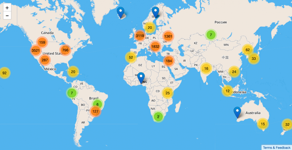
You can also learn more from the actual announcement and the blog entry with details. And of course, you want to see the coverage map, right?

GeoExt 2.0.0 Released

The GeoExt community is proud to announce the release of GeoExt 2.0.0.

GeoExt 2.0.0 is the first official GeoExt version that is built atop of OpenLayers 2.13.1 and ExtJS 4.2.1. It is being released 2 weeks after release candidate 1 was published and no serious bugs were discovered.
The newest major version of GeoExt wants to provide mostly the same API you know and love from the 1.x-series. It comes with support for the autoloading-mechanism of ExtJS, support for the single-file build tool of sencha and with exhaustive documentation that is built using the same tools that the mother library ExtJS uses.
This release wouldn't have been possible without the sponsors of the above mentioned sprint. Also we want to thank the companies behind the contributors of GeoExt for supporting GeoExt development in numerous ways and for such a long time.
We invite you all to use GeoExt 2!