Tag Archives: 3D

Google Building Maker Discontinued

Yesterday Google announced that they are discontinuing Google Building Maker as of next June. We mentioned Google Building Maker several times in the past, and while the 3D buildings built using this tool could not be as good as with professional grade data and tools, it was an easy way for anyone to quickly create 3D buildings. This isn't surprising considering that Trimble acquired SketchUp from Google a year ago and that Google launched last June their new 3D models for Google Earth, which doesn't use user-created rectangles anymore ;-)

Also lost to Google users in the same Spring cleaning effort is Google Reader, while this tool isn't geospatial-related, I use it daily to aggregate the geonews for Slashgeo. Hopefully there are alternatives. Google are nice enough to tell us in advance and provide a way to export our data, but it does demonstrate what can happen when you rely on tools you don't control. The same warning applies to proprietary geospatial tools, especially the cloud-based ones (which can 'disappear' anytime), that we rely on to do our work.

Read More »

Point and Shoot 3D Modeling

Not the first time we hear about this, but it's getting easier and easier, Slashdot discusses a story name Point and Shoot 3D Modeling (Video).

Their summary: "Slashdot editor Tim Lord was wandering around SXSW and ran into a small display for Lynx Laboratories, a startup that makes this claim about its Lynx A camera: "If you can use a point-and-shoot Nikon, you'll find the Lynx even easier to use. Instead of outputing 2D images, it produces 3D models of whatever you point it at. It's faster and cheaper than existing solutions today." There's a two-minute demo at the end of the video in which Lynx Founder and CEO Chris Slaughter shows how it works, and (at least in his hands) it looks extremely easy. The company is a University of Texas spinoff that "has received prestigious awards including the 1st Place Idea2Product (I2P) Texas, 1st Place I2P Global, Top 10 Dell Innovators and National Science Foundation Small Business Innovation Research Funding." Naturally, they're hoping to raise money through Kickstarter as well. They're looking for $50,000 and as of 13 March it looks like they've raised $88,548 of it. There are obviously other ways to make 3-D images and models. But Lynx seems to have made a novel device, and the images it makes can be picked up directly by a number of 3D printer software packages. The Lynx-A also does motion capture, which could really speed up rotoscoping and other techniques that make video games and other animations look more lifelike than pure animation. That's totally different from static 3D modeling but might be more interesting to more people, at least in a commercial sense."

Read More »

Google Geonews: New 3D Imagery for Cities, Mapping Meteo Impacts, Google Earth for Research Book, Multiplayer Games, and more

I have a lot of geonews to catchup. You'll get everything that's pertinent (at least from my point of view ;-), but just a bit later than usual. Thanks for your patience!

Here's the recent Google-related geonews. Nothing major, but several interesting items.

From official sources:

  • The first update to the Google Maps SDK for iOS
  • Google informs us that Ski Resorts are now on Google Maps

From other sources:

  • The GEB informs us that Google released 3D imagery in Berne (Switzerland), Anaheim (California) and other cities around the world
  • Ogle Earth has an entry named Reconstructing the Chelyabinsk meteor’s path, with Google Earth, YouTube and high-school math
  • Related, the GEB has an entry named Mapping meteor impacts
  • Still the same source a book named "Google Earth and Virtual Visualizations in Geoscience Education and Research"
  • The GEB shares a kmz to watch U.S. watersheds in Google Earth
  • The GEB reminds us that we can animate GPS tracks in Google Earth
  • You're an Olympics fan? Previewing the Winter Olympics in Sochi
  • If you prefer Grand Prix racing, Ride along GP tracks from all over the world
  • There has been games for Google Earth for a while, but now we're talking about multiplayer games: Two player driving shooter game in Google Earth
Read More »

Why Hasn’t 3D Taken Off For the Web?

I'm abroad this week, expect return to normal geonews coverage next week, thank you for your patience.

Slashdot discusses a story named Why Hasn't 3D Taken Off For the Web?

Their summary: "With HTML5 we're closer to the point where a browser can do almost everything that a native app can do. The final frontier is 3D, but WebGL isn't even part of the HTML5 standard, Microsoft refuses to support it, Apple want to push their native apps and it's not supported in the Android mobile browser. Flash used to be an option but Adobe have dropped mobile support. To reach most people you'd have to learn Javascript, WebGL and Three.js/Scene.js for Chrome/Firefox, then you'd have to learn actionscript + flash for the microsofties, then learn objective c for the apple fanboyz, then learn Java to write a native app for Android. When will 3D finally become available for all? Do you think it's inevitable or will it never see the light of day?"

We mentioned WebGL often lately, with many geospatial web tools betting on it.

Read More »

8th 3D GeoInfo Conference

3D GeoInfo 8th 3D GeoInfo Conference & ISPRS WG II/2 Workshop

“Advances in Multi-scale and multi-dimensional modeling and data representation”

27-29 November
 
CALL FOR PAPERS
 
Topics
 
Amongst others, the following subjects will be addressed by the conference
 
3D geo information requirements
3D spatial data infrastructures and 3D data integration
3D data acquisition (LiDAR, photogrammetry) and processing
3D GIS and time / 4D models
3D in spatial databases
3D standards for geospatial technologies
3D open source development
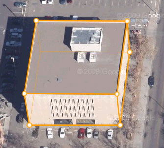
3D city models and building modelling
3D geometry and topology
3D visualisation, augmented and virtual reality
3D spatial analysis and simulation
3D indoor and outdoor navigation
3D applications (e.g., cadastre, utilities, city and urban planning, geology, disaster and risk management, environmental simulation, etc)
 
Publications
Researchers are invited to submit full papers (up to 6000 words) or extended abstracts (1000-1500 words) describing original and unpublished fundamental scientific research and application.All manuscripts will be subject to peer review process.
 
Full Papers:
 
Researchers are invited to submit full papers (up to 6000 words), selected set of full papers will be published within the  Lecture Notes in Geoinformation and Cartography (LNG&C) series by Springer. All accepted  abstracts will be published in the ISPRS Annals/Archives with ISBN/ISSN reference.The authors will be given regular slots for oral presentation.  A set of papers will be selected for Special Issue of  International Journal of 3D Information Modeling (IJ3DIM).
 
Extended Abstracts:
 
Researchers are invited to submit extended abstracts (1000-1500 words) describing original and unpublished fundamental scientific research and application. All manuscripts will be subject to peer review process.All accepted extened abstracts will be published in the ISPRS Annals/Archives with ISBN/ISSN reference.The authors will be given short slots for presentation.
 
ISPRS Workshop:
 
Researchers are invited to submit full papers (up to 6000 words).All accepted  abstracts will be published in the ISPRS Annals/Archives with ISBN/ISSN reference.  The authors will be given regular slots for oral presentation. Workshop papers will be included in  WG II/2 Workshop Issue of  International Journal of 3D Information Modeling (IJ3DIM).
 
Guidelines for all forms of submissions are according to templates are provided on the submission page. Please submit all abstracts and papers through the website according to the following deadlines:
 
Full Paper Submission (Regular Presentation) Route :
Abstract submission : 15 March
Notification of abstract acceptance :20 March
Full paper (6000 words) submission: 1 May
Notification of acceptance  :15 June
Camera ready submission: 1 July
 
Extended Abstract (Short Presentation) Route:
Extended abstract (1000-1500 words) submission: 1 May
Notification of acceptance  :15 June
Camera ready submission: 1 July
 
ISPRS Workshop Submission Route:
Abstract submission : 15 March
Notification of abstract acceptance :20 March
Full paper (6000 words) submission: 1 May
Notification of acceptance  :15 June
Camera ready submission: 1 July
 
Read More »

Batch Geonews: Voxel.js Minecraft-like, QGIS for Android, Side-by-Side Router, and much more

Here's the recent geonews in batch mode.

On the open source front:

  • 3D and open source with WebGL mixed with games gives you Voxel.js: Minecraft-like Browser-Based Games, But Open Source, which can certainly be reused for other geospatial projects
  • Never mentioned here before, an QGIS for Android in development, and on a similar topic, QGIS Globe works again
  • OpenStreetMap's new editor named iD gets a new home and updates, ideditor
  • After last year's success, NASA launches second International Space Apps Challenge, open data and open source
  • MapBox-related news:
    • Of course, MapBox Maps Now Embed On Twitter
    • You can now embed MapBox interactive maps in Apple iBooks Author software
    • An entry on Using Google Fusion Tables to Add Real-Time Feeds to MapBox Maps

On the Esri front:

  • The ArcGIS Online World Topographic Map first updates

On the Google front:

  • A nice Side-by-Side Router, allowing you to see directions for driving, transit, bicycling and walking on a same map
  • You can learn a bit more, Details of Google's Project Glass Revealed In FCC Report

In the miscellaneous category:

  • Microsoft shares a Bing Maps for Windows Store Apps Training Kit
  • And if developing for iOS, Apple Reaches Out to LBS Developers with iOS 6.1 POI Search API
  • Pretty interesting on the future of 3D photography, Light Field Photography Is the New Path To 3-D
  • Not the first time we hear about similar protections, In Brazil, Trees To Call For Help If Illegally Felled
  • Satellites (including footprints) and iPad / iPhone: New iOS app to view the SES Astra satellite info
  • I did not know that February 2nd is World Wetlands Day
  • Interesting on the Future U.S. Workforce for Geospatial Intelligence, the world needs need more geospatial experts
  • Which is also true considering 95% of of Public Safety Agencies Under-utilize Computer Mapping and GIS
  • A topic we discussed recently, Analytics for people, the next big thing in retail
  • If you have an interest in check-ins, 500 Million Foursquare Check-ins Visualized

In the maps category:

  • A different kind of map, Swiss Historical Maps Allow Journey Through Time In Your Browser
  • Map of the Geography of Abortion Access in the US
  • On the geography of languages, here's entries named World Maps of Language Families, World Maps of Language Families, Continued, and Remaining Language Families and Geographical Language Groups
  • Let's close this batch mode edition by another funny xkcd on mapping

Read More »

NEW 4D/5D earth, ocean, atmosphere scientific visualization software

Makai Ocean Engineering, Inc. has released a full-featured version of its Makai Voyager™ geospatial visualization software. Version 1.2 enables users to import and visualize their own scientific and GIS data in a “Google Earth-like” viewer.

KAILUA, HAWAII – Makai Ocean Engineering, Inc. has released a free trial version of its geospatial visualization software, Makai Voyager. This release represents a leap forward in advanced volumetric data visualization and analysis. Individual or group licenses are available on Windows (32- and 64-bit), Linux, and Mac OS X.

Originally developed for the US Naval Oceanographic Office’s large ocean models, Makai Voyager enables users to import, fuse, view, and analyze large earth, ocean, and atmosphere scientific data as it is collected or simulated in a global geo-referenced GIS platform. The key differentiator of Makai Voyager is its level-of-detail (LOD) technology that enables users to stream 'big data’ rapidly over a network or the web.

Features in Version 1.2:

•             Preprocessing LiDAR, GIS, & volumetric data from common formats into streamable files;

•             Volume rendering for large 4D (3D + time) data, such as NetCDF;

•             Analysis tools & customizable graphs;

•             WMS and other streamable formats;

See example project videos, or download the full-featured 30-day trial of Makai Voyager today!

Read More »

Batch Geonews: JS.geo, Instant StreetView, 3D Printing, Drones, Autodesk in the Cloud, and more

Here's the recent geonews in batch mode.

From the Esri front:

  • An interesting entry on Designing the next generation of online Topographic Maps
  • There's an ArcGIS Online World Topographic Map New Design which includes High-resolution imagery for South America, Australia, New Zealand, and Afghanistan
  • The Esri U.S. Demographic Data Release

On the web maps front:

  • We mentioned it before, and here's more details on JS.geo: A Meeting of Javascript Mappers in Denver
  • There's a new site to give you Instant Google Street View (direct link)... worth trying, it's really fast
  • Also Google-related, the GEB talks about GPS4Sport that combines GPS with Video and Google Earth
  • On Apple Maps
    • Rumors of OS X 10.9 to Include Siri and Maps Integration
    • A lot of geoblogs mentioned that Apple axed the head of its mapping team, Richard Williamson (more here)
  • Microsoft added New Imagery Added to Windows 8 Maps App & Bing Maps
  • The MapBox iOS SDK hits version 0.5.0
  • Two weeks ago, TomTom launched its SDK for LBS Apps, including maps, geocoding, routing, traffic

In the miscellaneous category:

  • Launched less than 10 days ago, MarineRegions, "towards a global standard of georeferenced marine names" (via Kurt)
  • A slashdot story named French Company Building a Mobile Internet Just For Things
  • While 3D printing have most of its applications outside of geospatial, I found interesting that it's really going mainstream as demonstrated by Staples To Offer 3D Printing Services, an O'Reilly story named Printing ourselves, the state of 3D Printing Patent Suits (via OR), and yes, you can 3D-print your own drone
  • More news about drones:
    • The Make magazine offers a gift guide for aerial drones (via OR)
    • But beware, High Levels of Burnout in US Drone Pilots (via OR)
  • VerySpatial offers an entry on Forensic GIS and the Role of Geospatial Technologies for Investigating Crime and Providing Evidence
  • Apparently, there's Nokia offline maps available in Firefox OS (alpha)
  • If you're excited by OGC standards
    • There's the development of an international standard for 4D archaeological data
    • And soon, Augmented Reality Standard ARML 2.0 in its Final Stage
  • If you're in the U.S., you'll be interested by the GAO Report on Federal Geospatial Data Coordination
  • You wonder about earth observation satellites from Russia? Here's news about the Resurs-P with 3-m hyperspectral capabilities and other Russian satellites
  • As part of Autodesk University, you'll find the Autodesk CEO saying “I do believe that everything is moving to the cloud.” and an entry indicating that Autodesk's future is in the cloud

In the maps category:

  • Interesting maps, U.S. Geography of Personality: The United States of Mind
Read More »

Google Geonews: Ingress LBS+Augmented Reality Game, Ski Resorts, Mining Atlas, and more

I've been overly busy lately, please allow the delay. Here's the recent Google-related geonews.

From official sources:

  • Google is ready for winter, Mapping the Canadian Arctic and global ski resorts
  • Here's a story about A 5,000-mile walk across Asia, guided by Google Maps
  • For the U.S., here's a map related to Zagat’s America's Top Restaurants revealed
  • Here's the official entry on the imagery update two weeks ago

From other sources:

  • The GEB invites us to explore over 10,000 mines with Mining Atlas in Google Earth
  • It also informs us how to create amazing Google Earth tours with TourMaker
  • And in the same direction, a great 3D driving simulator that uses the Google Earth plug-in
  • APB made me aware of Google's new location-based + Augmented Reality game named Ingress, see its introductory video below. Here's how APB summarizes it:
    • There are two teams: “The Enlightened,” who embrace the power, or “The Resistance,” who fight the power.
    • You get "energy" by visiting real wold paths (like a human PacMan).
    • You go on missions to portals which are associated with real places like libraries, public art and onter public places.
    • There's a tie in to real world vendors and products (Hint Water, Zipcar, Jamba Juice and Chrome apparel and messenger bags).
Read More »

Batch Geonews: JS.geo Conference, ArcMap2SLD, MapQuest Discover, GLONASS Corruption, and much more

Here's the latest batch-mode edition of the geonews.

From the open source front:

  • InaSAFE 1.0 launched, it's a "free software that produces realistic natural hazard impact scenarios for better planning, preparedness and response activities", it's also a QGIS plugin

From the Esri front:

  • Interested by the SLD standard? Here's about converting an ArcMap project file into an SLD document with ArcMap2SLD
  • Here's how to add access to various formats to ArcGIS using GDAL/OGR
  • Here's How to build an Apple Map app for iOS using the ArcGIS Runtime SDK for iOS

From the Google front:

  • Google reminds us to let indoor Google Maps be your guide this holiday shopping season
  • There were Big updates to Google Mars
  • There's also Google Earth Outreach in Australia and New Zealand now

In the miscellaneous category:

  • Bill Gates writes about GIS, GPS and maps, Digital Mapping Technology Helps Polio Vaccinators Zero In
  • Here's another must-read entry on the GIS crisis from Brian Timoney, arguing that (Domain Experience + GIS)   >   (GIS + domain experience)
  • James tells us about the upcoming JS.geo Geospatial JavaScript conference in Denver January 14-15, attendance is also only 10$
  • Another story on Secret Stingray Warrantless Cellphone Tracking
  • GLONASS corruption exposed and 200M$ stolen, GLONASS Satellite System Designer Fired
  • An Apple Maps consequence; Scott Forstall Reportedly Forced Out of Apple
  • A few news from MapQuest, New MapQuest Gas Prices App and MapQuest for iPhone with Traffic-Influenced Directions, and they also introduced MapQuest Discover, a new MapQuest Local, and more: "a photo-centric social and travel experience centered on places that people may want to explore"
  • Geospatial isn't just for driverless cars, Motorcycle App Helps You Ride Faster, Turn Sharper, Brake Harder
  • We already know about drones, More Drones Set To Use US Air Space
  • An article on Taking the 'Pulse' of Volcanoes Using Satellite Images
  • Meet the World's First 3D Printing Photo Booth and on that topic, How to print a 3D Google Earth building using Makerbot
  • APB provides Bentley Systems by the Numbers
  • Apparently, U.S. Weather Satellites Are Dying
  • Here's a different 3D game, where you learn about the effects of the speed of light (via ORR)
  • Here's a generic article on how web mapping is helping government improve communications and services

And finally, at the suggestion of a Slashgeo user which made a donation, we added a 'Paypal button' to ease the process of making donation to Slashgeo.

Read More »