Tag Archives: GeoServer

GeoServer 2.3.0 Released, First Official OSGeo Release

[this story was submitted by a user as a press release (thanks!), I'm republishing it as a story too since it's a pertinent major release]

The GeoServer team is happy to announce the release of GeoServer 2.3.0, available for download.

This release contains six months worth of improvements and fixes to the GeoServer code base. Including several important new features and improvements such as:

  • A pluggable configuration subsystem (for the catalog and service configuration)
  • GeoWebCache clustering and disk quota improvements
  • More powerful layer groups and better control of the WMS capabilities layer tree
  • Several security subsystem improvements
  • WPS process whitelist (control which processes your WPS is exposing)
  • WMS dimensions support improvements (units, custom dimensions)
  • JSON and JSONP output format support in many OGC operations
  • The monitoring module finally graduating to official extension
  • Raster re-projection quality improvements and speedups
  • INSPIRE module improvements for the WFS protocol
  • A newfound ability to catalogue all components of GeoServer via a REST API

For those daring enough to try out nightly builds the 2.3.x series also offers a new scripting extension allowing you to write WPS processes and small applications in your preferred scripting language. Also included as a nightly community module available is a complete WCS 2.0 service implementation.

More information about the new features of the 2.3.x stream can be found in the  GeoServer 2.3-beta release announcement.

The good news do not stop there. GeoServer has finally completed the OSGeo incubation and it’s now an official OSGeo project. Many thanks to all that participated, in particular Jody Garnett for constantly pushing forward, Landon Blake for mentoring us, and all the people that participated to the FOSS4G-AU code sprint in which all of the grunt work of provenance review was done. We want to thank in particular Jody Garnett, Adam Brown, Karin Stronkhorst, Luca Morandini and Joshua Vote for the hard work.

OSGeo Project

And last but not least there have been some bug fixes since the RC1 release, you can find a full list in the GeoServer 2.3.0 changelog. Included in this list, for those willing to try out nightly builds, is a new fast WMS JPEG encoder based on libjpeg-turbo which should give a nice boost to your raster data serving.

Download GeoServer 2.3, try it out, and provide feedback on the GeoServer mailing list.  As with any new version, be sure to backup your data directory before upgrading.

Thanks again for using GeoServer!

Download GeoServer 2.3


Read More »

GeoServer 2.3.0 released, first official OSGeo release

The GeoServer team is happy to announce the release of GeoServer 2.3.0, available for download.

This release contains six months worth of improvements and fixes to the GeoServer code base. Including several important new features and improvements such as:

  • A pluggable configuration subsystem (for the catalog and service configuration)
  • GeoWebCache clustering and disk quota improvements
  • More powerful layer groups and better control of the WMS capabilities layer tree
  • Several security subsystem improvements
  • WPS process whitelist (control which processes your WPS is exposing)
  • WMS dimensions support improvements (units, custom dimensions)
  • JSON and JSONP output format support in many OGC operations
  • The monitoring module finally graduating to official extension
  • Raster re-projection quality improvements and speedups
  • INSPIRE module improvements for the WFS protocol
  • A newfound ability to catalogue all components of GeoServer via a REST API

For those daring enough to try out nightly builds the 2.3.x series also offers a new scripting extension allowing you to write WPS processes and small applications in your preferred scripting language. Also included as a nightly community module available is a complete WCS 2.0 service implementation.

More information about the new features of the 2.3.x stream can be found in the  GeoServer 2.3-beta release announcement.

The good news do not stop there. GeoServer has finally completed the OSGeo incubation and it’s now an official OSGeo project. Many thanks to all that participated, in particular Jody Garnett for constantly pushing forward, Landon Blake for mentoring us, and all the people that participated to the FOSS4G-AU code sprint in which all of the grunt work of provenance review was done. We want to thank in particular Jody Garnett, Adam Brown, Karin Stronkhorst, Luca Morandini and Joshua Vote for the hard work.

OSGeo Project

And last but not least there have been some bug fixes since the RC1 release, you can find a full list in the GeoServer 2.3.0 changelog. Included in this list, for those willing to try out nightly builds, is a new fast WMS JPEG encoder based on libjpeg-turbo which should give a nice boost to your raster data serving.

Download GeoServer 2.3, try it out, and provide feedback on the GeoServer mailing list.  As with any new version, be sure to backup your data directory before upgrading.

Thanks again for using GeoServer!

Download GeoServer 2.3


Read More »

Open Source Geonews: OSM2GIS, OSGeo-Live 6.5, OSGeo Board Priorities, OpenBlock Project, JTS Union VS ArcGIS Dissolve, and much more

Still catching up, here's the recent open source geospatial news.

New software:

  • VIa OGD, an easy to use website, OSM2GIS to directly download OpenStreetMap data in GIS formats such as shapefiles and kml
  • MapTiler (mentioned in), which is an open source map overlay generator for Google Maps / Earth and a GUI for GDAL2Tiles, now has a free Mac App Store version

Software updates front:

  • Version 6.5 of the OSGeo-Live GIS software collection has been released, including 50 quality geospatial open source applications installed and pre-configured
  • There's Leaflet.draw 0.2 released, and as you can guess it's for drawing/editing vectors in Leaflet
  • Via UD, the color advice for cartography, ColorBrewer 2.0 has a no-flash version now
  • Updated, MapStore 1.1.0 released
  • Also available, GeoServer 2.2.5 released
  • And so is GeoTools 8.7 Released
  • Another one, ImageI/O-Ext 1.1.6 Released

Everything else:

  • Here's an entry on the OSGeo Board priorities
  • Related, a nice graph of the Moments in the History of OpenStreetMap
  • Hyper-local data and news tool Everyblock closed, and it's open source code will continue as the OpenBlock Project, related, DM shared an article named OpenBlock Rural Finds Three Key Audiences for Open Data
  • We love numbers right? At the beginning of last month was a user test between JTS Union VS ArcGIS Dissolve, result: 25 seconds vs 1.5 second in favor of the open source JTS
  • Probably of interest to some of you, an entry on Optimizing OpenLayers for Mobile Applications
  • DM shares an article named [U.S.] FedGeoDay: Advocating for Open Source, the summary: "FedGeoDay, held in Washington, D.C. this past week, can best be described as an advocacy forum for open source geospatial technology and data. Some of the leading organizations, government agencies and companies invested in open source tech sponsored the conference."
  • Another article from the same source, The Arches Project: Turning Open Source GIS into a Heritage Inventory and Management System
  • And a last article from DM, Palantir: An Open Source Development Success Story, which is really about leveraging PostGIS, the summary: "In late Palantir launched Gotham, a new geospatial and comprehensive analytics platform designed to meet the challenges of their vast array of customers. This article provides more information on Gotham that enables data integration, search and discovery, knowledge management, secure collaboration, and algorithmic analysis across a wide variety of data sources."
Read More »

GeoServer 2.2.4 Released

The GeoServer team is happy to announce the release of GeoServer 2.2.4, now available for download.

This is the latest release of the stable 2.2 series. The changes that might interest the most users are:

  • the monitoring extension module just got promoted to official extension [GEOS-5538]
  • the status page does not throw errors after catalog reloads anymore [GEOS-5371]
  • one critical fix in the REST configuration of freemarker templates [GEOS-5533]

The changelog also contains the following minor bug fixes

  • [GEOS-5338] – Filter function IEEERemainder mishbehaves in SLD
  • [GEOS-5537] – Tiling artifacts with RasterSymbolizer using bilinear interpolation (when oversampling raster)
  • [GEOS-5551] – WFS 1.0 capabilities will NPE with misconfigured OGR and XSLT output formats
  • [GEOS-5565] – workspace admin unable to create sql view
  • [GEOS-5570] – QueryProcess fails if called with an OGC filter (either 1.0 or 1.1)
  • [GEOS-5197] – Use the layer abstract as the GeoRSS channel description
  • [GEOS-5561] – Missing i18n support for ReprojectPage
  • [GEOS-5562] – Missing i18n support for WorkspaceEditPage
  • [GEOS-5563] – slight mixed up order of Y-parameters in AffineTransformPanel

Also, looking at the corresponding GeoTools release changelog we have the following extra goodies in:

  • improvements in the WFS cascading, we can now better interact with remote WFS servers running on TinyOWS and ArcGIS
  • imageio-ext was upgraded to version 1.1.6, which means from now on GeoServer uses GDAL 1.9 to extends the range of raster formats it supports

Download GeoServer 2.2.4, try it out, and provide feedback on the GeoServer mailing list.

Thanks again for using GeoServer!

Read More »

Batch Geonews: Landsat 5 Decommissioned, GeoPackage RFC, Geocoding Client API in GDAL/OGR, Drone Stories, and much more

This is an abnormally long version of our 'batch geonews' edition, covering the news since the holiday break.

On the open source & open data front:

  • This entry discusses the new geocoding client API in GDAL/OGR
  • Good news, QGIS gets built-in Oracle support, along with New QGIS PDF and HTML manuals and New QGIS Symbol Packages
  • James informs us on the GeoPackage Comment Period is Open, GeoPackage what? Read this previous entry named OGC Draft GeoPackage Specification - Finally the Shapefile Format Replacement?
  • James is also enthusiastic about D3.js for its map visualization capabilities
  • More in the useful chaining Rendering Transformations in GeoServer
  • In case you missed the press releases, GeoTools 8.5 released and GeoServer 2.2.3 released
  • Freely available course named Java Open Source GIS Development - From the building block to extending an existing GIS application
  • Here's an entry on using PgRouting with Mapserver

On the Esri front:

  • The ArcGIS API for JavaScript Version 3.3 Released

In the miscellaneous category:

  • It's really the end now, mission accomplished, Landsat 5 will be decommissioned (via VS)
  • Follow this link if you have an interest in 30+ years of LAI and FAPAR data for Your research use
  • Microsoft shares an entry on Getting started with Bing Maps Windows Store Apps
  • Here's an interesting top 10, Top 10 Spatial Law and Policy Stories from
  • DM shares an article named Intergraph Retools, Revamps Entire Geospatial Product Suite
  • Beidou, aka as Compass, China’s GNSS, is now available for Commercial Use in Asia
  • O'Reilly discusses the inevitability of smart dust, where geospatial-aware sensors are to be found everywhere
  • Here's geospatial studies of atmospheric lead as a dangerous pollutant
  • Here's a funny xkcd cartoon on 'simplifying' map directions

A bunch of minor geo-related stories discussed over Slashdot:

  • Nice use of drones: Drone Photos Lead to Indictment For Texas Polluters
  • Also on drones: Researchers Seek to Use Drones For Brushfire Forecasting
  • A real-time map of those bushfires was up: Australia Is On So Much Fire, You Can See It From Orbit
  • Remote sensing satellites in jeopardy thanks to the fiscal cliff: Going Off the Fiscal Cliff Could Mean Missing the Next Hurricane Sandy
  • Slashdot just discovered OpenFlights, which we mentioned years ago: Visualizing Personal Flight Data With OpenFlights
  • Benefits and inconveniences of being tracked: Disney Wants To Track You With RFID
  • Also on RFID: Texas High School Student Loses Lawsuit Challenging RFID Tracking Requirement and Texas State Rep. Files 2 Bills To Ban RFID In Schools

In the maps category:

  • Pretty interesting map, one that more or less works both upside down and... upside up! (screenshot below)

GeoServer 2.2.3 released

The GeoServer team is happy to announce the release of GeoServer 2.2.3, now available for download.

This is the latest release of the stable 2.2 series and contains some small new features and interesting fixes:

  • [GEOS-3885] – Update Freemarker templates through REST API
  • [GEOS-5325] – Add title and abstract to LayerGroupInfo
  • [GEOS-5462] – The rendering thread can block forever under request cancellation
  • [GEOS-5479] – Error in Documentation: </PropertyName> tag used instead of </Literal>
  • [GEOS-5483] – json output in WPS extension does not work due to missing library
  • [GEOS-5485] – Border artifacts when reprojecting single banded (scientific) raster data

Also, looking at the corresponding GeoTools release changelog we have the following extra goodies in:

  • better support for chaining rendering transformations
  • fixes to time/date handling in CQL
  • Oracle specific SDO_NN function to find the N nearest objects to a given location

We also welcome our newest committer, Davide Savazzi, and thank him for the work on Freemarker template through the REST API and the title and abstract support in layer groups, as well as the SDO_NN work back in GeoTools.

Download GeoServer 2.2.3, try it out, and provide feedback on the GeoServer mailing list.


Read More »

FOSS4G Geonews: GeoServer CSS vs SLD, Cesium, SplashMaps, Open Bank Project Maps, and more

Here's the recent FOSS4G geonews.

In open source software updates:

  • GEOS, the Geometry Engine Open Source, got to version 3.3.6
  • The popular GeoServer got to version 2.2.2
  • Another bug fix release is the OpenGeo Suite version 3.0.1
  • It's not the end, GeoTools 8.4 was released

In the everything else category:

  • Here's an entry on the GeoServer CSS module, that presents itself as an alternative and improvement over the SLD (Style Layer Descriptor) OGC standard: "GeoServer CSS is inspired by the web—and by great tools like Carto, Cascadenik, and MapCSS. Like these tools it provides a concise styling syntax modeled on CSS but differs in that it’s goal is to improve the experience relative to SLD while preserving CSS concepts like cascading. While we ultimately aspire to a common CSS-like styling language for web cartography, we hope that GeoServer CSS is much easier than SLD and will be familiar enough for web designers to use."
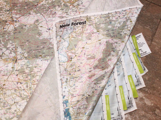
  • Arnulf links to the SplashMaps Kickstarter project that uses open data, "real outdoors maps; based on open data, on light, weather friendly fabric" (image below)
  • Geoff shares an entry on the Cesium open source WebGL virtual globe and mapping Javascript library, we mentioned Cesium before
  • You can now connect ArcGIS to the open source TileMill with Arc2Earth Sync
  • I learned a new term today, here's an entry named Improving Population Density Maps Using Dasymetric Mapping
  • Here's a Money Journey map that visualize transactions with the Open Bank Project data
  • Here's an update on the Geometry Clipping Contest, and QGIS beats ArcGIS
  • You heard of it already, but here's again on the topic, Why are we building OpenLayers 3?

Read More »

Open Source Geonews: Learn CartoCSS, States of GeoServer and GeoTools, ArcGIS vs QGIS Clipping, and more

Here's the recent open source geonews.

  • Geoff anticipates the next step in the evolution of open source geospatial software will be corporate engagement
  • MapBox offers you to learn CartoCSS and compositing by customizing Geography Class and the open source TileMill
  • We more about why the need for OpenLayers 3.0 to be developed
  • Many of you will probably be interested by the State of GeoServer and State of GeoTools presentations, related, GeoTools 8.3 has been released
  • Here's some partial results on the ArcGIS vs QGIS etc Clipping Contest Rematch revisited
  • Via this upcoming introductory course for accessing it using open source software, I learned about WELD, USGS's Web-Enabled Landsat Data products
  • You can open MODIS tiles directly in QGIS
  • Here's how to add layers to GeoServer using the REST API
  • If you have anything to do with New Zealand, head to this mapping New Zealand summary, which extensively uses open source
  • This year, the Sol Katz Award has been attributed to Prof. Venkatesh Raghavan
Read More »

GeoServer 2.2 Released

Almost a week ago, one of the most popular web mapping server engine has been updated, GeoServer 2.2 has been released. As they wrote: "The release of a new major version update is a big deal (the last one was over 16 months ago) [...]", here's some of the highlights, follow to link to get the full overview!

  • NTv2 and NADCon Support allows for datum transformations with cm level precision
  • Continued work for supporting high accuracy datum transformations
  • A new reprojection console
  • The image collection coverage store allows users to serve un-referenced data through WMS using image/pixel space as the coordinate system
  • Support for WFS 2.0 adds some interesting new capabilities to the WFS protocol
  • Support for additional dimensions brings time and elevation support to both vector and raster data. And, with support for time, comes support for animation in WMS.
  • GeoWebCache configuration GUI is now available directly from within the GeoServer web admin interface

And much much more...

Read More »

Open Source Geonews: Esri Diving into Open Source, India Launches Open Data Portal, Open Transit, MySQL vs PostGIS, and more

Still catching up my August holidays, here's the recent geospatial open source and open data geonews.

In general news:

  • O'Reilly publishes an article named With new maps and apps, the case for open transit gets stronger: "There’s no reason why important civic infrastructure should get bound up in a fight between Apple and Google. And in communities with public GTFS, it won’t."
  • Esri published an update on their relation with open source: "Esri has always hosted open code and samples in a variety of ways, but more can be done. Focus and motivation needs to be improved, and Esri is now making it a priority to improve its open source participation. More of Esri’s code should and will be open sourced in the coming days, weeks, months, and years." They are also on Github.
  • sxdf
  • India launched the beta of their open data portal
  • MapQuest have a New Geocoding Service and Updated APIs Based on Open Data
  • OpenGeo shares an article named Haitidata: using open source geospatial for disaster response planning
  • FOSS4G software getting adopted, gvSIG 1.11 now official part of the standard software portfolio in the City of Munich and Luxembourg using open source GIS for cadastre
  • DM shares a 2-parts article named Designing an Open Source Geospatial Solution to Manage Airport Noise and Operations
  • For the curious ones, here's the new OSGeo Board and Charter members refreshed

In software news:

  • The OSGeo-Live 6.0 GIS software collection has been released
  • A serious OpenLayers competitor, Leaflet 0.4 has been released, actually, they're at version 0.4.3 now
  • Believe it or not, MySQL inches closer to PostGIS with support of true spatial relationship functions
  • Here's a short entry on Surface Interpolation in GeoServer and there's a new release, v 1.4.3, of GeoServer-Manager
  • Nathan is enthusiastic about Five new awesomely awesome QGIS features, here's more on the Latest Style User Interface Improvements
  • There's a new winGRASS 7 with R-integration
  • Where's MapGuide Open Source? Here's MapGuide state of the union address (or: Results of the user/developer survey)