Recent Posts

Raster support in MapCentia GeoCloud2 (GC2) and new server images

Raster support
Since PostGIS version 2, raster has been supported in the database. The raster data model can dramatically increase the use of PostGIS as a analytical and visualization tool. For example elevation models and a lot of environmental data are based on the raster data model.

Now GC2 supports PostGIS raster data. Raster layers will be displayed in the list of layers in the database tab and you can manage them in the same way as vector layers. Raster layers will also be added to the tile and WMS services and you may classify them. You can also query the raster tables through the SQL API.

Read more about raster support and how you upgrade your own GC2 installation

New Ubuntu 14.04 server images
Ubuntu 14.04LTS (Long Term Support) was released in April and is packed with newer versions of the geospatial software. We are ready with a new vmdk file for use in VMWare products, Oracle VirtualBox etc. The highlights are:

PostGreSQL 9.3
PostGIS 2.1
MapServer 6.4
Apache 2.4
GDAL 1.10
PHP 5.5

You can also spin a GC2 server up at Amazon Web Services in a couple of minutes.
Europe or USA

If you want to install from scratch instructions for Ubuntu 14.04 are ready
What are Earth Observation and Remote Sensing Jobs?

Earth Observation Directory (EOD) provides worldwide job positions related to Earth Observation and Remote Sensing since more than a year and it recently announced an detailed analysis of all their job opportunities.

In which country you can find the most of opportunities? Which skills are the most commonly required? And, what about salary expectations? These are some of the questions, which they wanted to answer. As a result, they set up an interesting profile of the Remote Sensing & GIS Specialist. For example, it shows that most of opportunities are provided by governmental institutions like universities and research laboratories. Moreover, it highlights that besides usual GIS software abilities, language programming is more and more required.

The complete analysis is available at this URL :

Batch Geonews: OpenAddresses, csw4js, GeoPackage Support in ArcGIS, Historic Street View, and much more

Here's the recent geonews in batch mode.

On the open source / open data front:

  • We talked about the beta OpenAddresses in, now OpenAddresses has launched
  • Here's thoughts from State of the Map US and Peter Batty's report of SofM US, including the new Vector Tiles for OpenStreetMap and discussion over licensing
  • A new open source project, the missing CSW library for JavaScript: csw4js
  • Using QGIS? Learn more about Composition styling in QGIS 2.2
  • In software updates, GeoServer-Manager 1.6.0 released and GeoTools 10.6 Released

On the Esri front:

  • Good news for standards, support for OGC GeoPackage specification in ArcGIS.
  • A fourth Esri app for iPad and iPhones, Now Available: Explorer for ArcGIS on iPad and iPhone, "Explorer for ArcGIS gives you a first class experience for accessing your geospatial data on a mobile device."
  • More openness at Esri, ArcGIS Solutions symbols now have a repo on GitHub, of course, don't forget about the open Maki geo-symbols
  • There's an upcoming free  online seminar on Arc2Earth and Using Google Maps Inside Esri’s ArcGIS
  • Esri has a New Ocean Basemap

On the Google front:

  • We can now browse StreetView "historical" imagery, Go back in time with Street View
  • The two are slowly merging, The long history of Google Earth in Google Maps
  • Interesting, a book on The History of the World with Google Earth
  • In the official Google blog, The latest chapter for the self-driving car: mastering city street driving, and Slashdot discusses Google Using Self-Driving Car Data To Make Cars Smarter
  • Eyes in the sky, Google Buys Drone Maker Titan Aerospace
  • Ogle Earth shares an entry named What does Crimea tell us about Google?
  • As there frequently is, New Google Earth Imagery – May 1, and this one too, New Google Earth Imagery – April 16

In the miscellaneous category:

  • Want to understand MapBox via educational guides? Introducing Mapbox Foundations and they also have two new products, Mapbox Launches Smart Directions and Introducing Mapbox Outdoors
  • In Europe? The final Copernicus Regulation has been published, "Copernicus, previously known as GMES (Global Monitoring for Environment and Security), is the European Programme for the establishment of a European capacity for Earth Observation."
  • Impacts of Ukraine, Russian sanctions have killed Canadian satellite launch
  • Not the first we mention this, The Commoditization of the Earth Observation Satellite Business
  • Google Glass? You can build your own, DIY Wearable Pi With Near-Eye Video Glasses
  • O'Reilly has a long and informative entry on iBeacons, privacy, and security
  • Also Apple-related, Apple acquired 24 companies in the past 18 months, including several mapping apps, including BroadMap, Embark, HopStop, Locationary, and WiFiSlam, along with other notable additions like 3D company PrimeSense
  • And yes, Apple and Google can work together sometimes, Google's 'Project Tango' Smartphone Uses Apple's PrimeSense Technology
  • MapQuest playing nice with popular open source libraries, Announcing MapQuest Plugins for Leaflet on Licensed and Open Data
  • Remote sensing and mapping of citizens, Eyes Over Compton: How Police Spied On a Whole City
  • If you haven't heard of 'Nearby Friends' yet, New Facebook Phone App Lets You Stalk Your Friends
  • It's Facebook so it must matters? 😉 Facebook acquires activity-tracking app Moves
  • A discussion regarding The Best Parking Apps You've Never Heard Of and Why You Haven't
  • 3D coming to your phone? Amazon's Smartphone with 3D Capabilities Revealed in New Photos
  • Based on where you live, UK Life Expectancy and Spatial Analysis

In the maps category:

  • Via APB, a map of the Countries With The Worst Suicide Rates
  • Wired published a story named 400 Years of Beautiful, Historical, and Powerful Globes
  • Also from Wired, 18 Maps From When the World Thought California Was an Island
  • An atlas, Global Renewable Energy Atlas
  • TMR mentions two books about Art and Personal Mapmaking
  • And if you're into poems, Map – poem by Wislawa Szymborska

Esri Launches ‘ArcGIS Open Data’ in Beta

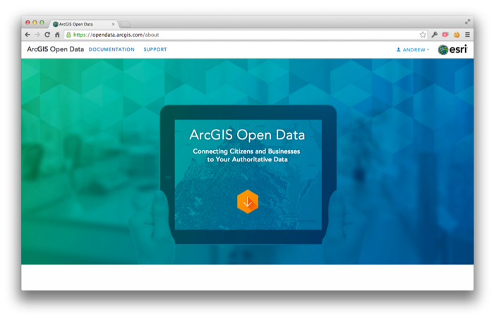
Last Thursday Esri announced the launch of the 'ArcGIS Open Data' initiative in beta. Having this major player enhancing access, in their own way, to open geospatial data can only help.

From their announcement: "Starting today any ArcGIS Online organization can enable open data, specify open data groups and create and publicize their open data through a simple, hosted and best practices web application. […] For you Data Providers, you can participate in open data in a few ways. Foremost you can specify open data groups and items in your organization. By doing so, you indicate to the community that this data is open to be shared, downloaded, and reused in other open data sites and applications. You don’t need to actually host your own site for your data to be valuable to others. […] On the other side, Data Consumers such as citizens, businesses and developers can begin using their local open data sites to quickly access and download data in a variety of common formats: KML, Spreadsheet (CSV), Shapefile, GeoJSON and GeoServices. As the US Open Data Institute recently noted suggested the impact to opening government data if software had ‘Export as JSON’ by default. That’s what you now have. Users can also subscribe to the RSS feed of updates and comments about any dataset in order to keep up with new releases or relevant supporting information."

GDAL/OGR 1.11.0 Released: GeoPackage, Google Map Engine and OpenFileGDB Drivers and more

If there's one geospatial library that is ubiquitous, both in open source and proprietary software, it's that one. Lots of users may not even know they're indirectly using the open source GDAL/OGR library. Well, about a year after version 1.10.0, this widely used tool is now improved with this new version, GDAL/OGR 1.11.0.

The major changes according to the release notes:

  • New GDAL drivers:
    •  KRO: read/write support for KRO KOKOR Raw format
  • New OGR drivers:
    •  CartoDB : read/write support
    • GME (Google Map Engine) : read/write support
    •  GPKG (GeoPackage): read-write support (vector part of the spec.)
    •  OpenFileGDB: read-only support (no external dependency)
    •  SXF: read-only support
    •  WALK : read-only support
    •  WAsP .map : read-write support
  • Significantly improved drivers: GML, LIBKML
  • RFC 40: enhanced RAT support (#5129)
  • RFC 41: multiple geometry fields support
  • RFC 42: OGR Layer laundered field lookup
  • RFC 43: add GDALMajorObject::GetMetadataDomainList?() (#5275)
  • RFC 45: GDAL datasets and raster bands as virtual memory mapping
  • Upgrade to EPSG 8.2 database